|
11:28 on 24/2/25 |
Hazardous Weather Outlook
Forecast for the Northern Wasatch Front a courtesy of
|
||||
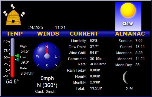
| Temperature | 54.8°F | ||||
| Dew Point | 37.5°F | ||||
| Humidity | 52 % | ||||
| Barometer |
25.30 in Rate -0.014 in/hr |
||||
|
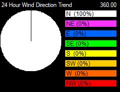
Wind Speed @ Direction |
0 mph @ N |
||||
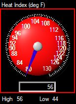
| Heat Index | 55.8°F | ||||
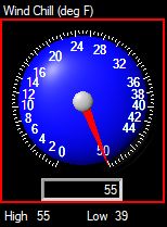
| Wind Chill | 54.8°F | ||||
| Rainfall for Today | 0.00 in | ||||
| 24 Hour Rainfall | 0.01 in | ||||
| Total Rainfall | 11.25 in | ||||
|
|
|||||
| High Temperature |
54.8°F at 11:27 |
||||
| Low Temperature |
39.0°F at 2:51 |
||||
| High Heat Index |
55.8°F at 11:27 |
||||
| Low Wind Chill |
39.0°F at 2:51 |
||||
| Peak Wind Gust |
0mph at 0:00 |
||||
| Peak Rain Rate |
0.007in/hr at 0:00 |
||||
|
|
|||||
| High Temperature |
52.4°F at 14:06 |
||||
| Low Temperature |
26.8°F at 3:00 |
||||
| 24 hours ago |
44.7°F changed by 10.1 |
||||
|
|
|||||
| Sunrise | 7:06 | ||||
| Sunset | 18:11 | ||||
| Moonrise | 5:25 | ||||
| Moonset | 14:21 | ||||