A Month in Chile 2018/2019
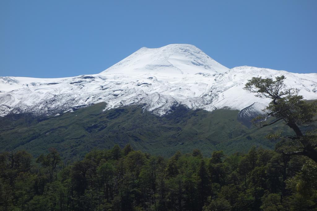
![/galleries/chile_2019_26_salto_petrohue_and_lago_todos_los_santos/001_Volcan_Osorno_across_Lago_Llanquihue_[Mon_Jan_14_12:06:40_CLST_2019].thumbnail.jpg](../galleries/chile_2019_26_salto_petrohue_and_lago_todos_los_santos/001_Volcan_Osorno_across_Lago_Llanquihue_%5BMon_Jan_14_12:06:40_CLST_2019%5D.jpg)
Bob Myers and I spent an entire month in Chile on vacation this winter. Bob of course is retired, and I managed to cobble together a month's paid vacation out of the dregs of my 2018 vacation days and half of my 2019 vacation days. We visited the central part of Chile, driving from Santiago south to Puerto Montt. We had a great time, and I took an absurd number of photos.
This post is an adaptation of my travel diary, by now heavily rewritten. I've tried to cut it down to size, but feel free to skip over stuff to find the interesting bits.
Some prefatory notes
On roads:
There's one long freeway that runs north and south through the central part of Chile, Ruta Cinco / Route 5. Driving on it is hair raising and exhilarating. There seem to be very few accidents (we did see one spectacular pile-up), but there are a lot more hazards than you might expect. Pedestrians cross the freeway in rural areas by running across all 4 or 6 lanes. Some people ride horses on the shoulders. Others ride bicycles on the median. You can come around a corner at 120 kph / 72 mph and meet someone trying to get their ancient sedan to the next exit with a flat tire, doing maybe 15 kph (happened to us on the way to Rancagua). There are fruit stands right on the shoulders, selling sandias (watermelons), duraznos (peaches) and tomates (tomatoes). There are also restaurants and little grocery stores. Onramps and offramps are very short, so you always have to look for very slow traffic exiting or entering. Traffic seems to be divided among speed demons (a small percentage), law abiders (who drive the 120 kph speed limit), and trucks / buses, who by law must drive at most 90 or 100 kph. The result is a lot like roller derby, where clots of traffic led by wheezing buses or little 1970s era Datsun minivans are attacked by brightly colored late-model pick-up trucks.
Chilean drivers are surprisingly polite, especially in comparison to their neighbors in Argentina, and especially when you get out of Santiago. Cars will actually stop to let you get into traffic or make a turn, which is a huge help on the narrow streets. Taxis are an exception to this rule, although I did see some polite taxi drivers too. Local buses can also be rude — watch out for their lane changes.
The belt freeways in Santiago are toll roads with electronic tag readers — no cash tolls. Be sure to rent a car with a transponder.
On money:
Both Bob and I had given our respective credit unions a heads-up about our travel to Chile, but my ATM card worked and Bob's did not. Note that our credit cards did work. Bob brought American cash and changed it to pesos.
While we were there, the exchange rate was about 680 Chilean pesos (CLP$) to the US dollar. Our rule of thumb for converting peso prices to dollars was to divide by 1000 and multiply by 1.5.
You need to carry cash for tolls on Ruta 5. I've heard complaints about the prices, but I didn't think they were that bad — about CLP$2500 at toll plazas and CLP$600 at minor exits. I did have a total brain fault at one toll plaza on Ruta 5 that didn't take money at all: instead, you're supposed to swipe the bar code from your previous toll payment under a bar code reader. I was so flummoxed by this that I had to put on the flashers and ask for help (which did not exactly make me popular!).
When you enter Chile, the police at the airport will give you a little receipt that looks trivial. Absolutely do not lose this receipt, which has PDI marked on it in big letters. You need this receipt to prove to hotel clerks that you are exempt from VAT (value-added tax) on hotel stays. Also, carabineros (police) will ask to see this receipt if you get pulled over, or if you try to cross into Argentina. Keep it with your passport.
On English and Spanish:
There are many English speakers in Chile, but we encountered a number of situations where nobody at an office or a store spoke any English. I used to think that my Spanish pronunciation was decent even if my vocabulary was very limited, but I had a rude awakening in Chile — I had to really work to be understood in Spanish. Conversely, I had a lot of trouble understanding the local conversational Spanish. I could understand the Spanish that I heard on TV (more or less), and I could read signs and menus. Your mileage may vary.
Chile has its own names for many fruits and vegetables. Even if you know some Spanish, you'll be guessing at least some of the time.
In Chile, a laguna is not a lagoon, in spite of Google Translate; it's just another word for a lake, usually but not always a lake that's smaller than a lago.
On Airbnb:
We booked a number of units through Airbnb. These places were cheaper than staying in hotels, but a number of them were also pretty funky. If you aren't prepared to survive plumbing issues or flaky wifi, stick to the hotels. Bob and I did just fine — it's better than camping!
On summer weather:
The area from Santiago down to Los Ángeles was dry when we were there. It reminded me of California summers. From Pucón on south, we had occasional rain days. We just had to work around them.
Day 0: Wednesday, 12/19: Departure
I flew on American and Bob flew United. American had changed my flight arrangements a couple of months earlier and had shortened my connection in DFW to just 55 minutes. My flight from SLC was 20 minutes late, so I had to sprint to get to the gate for the Santiago flight. I made it with literally a minute to spare.
I had spent a fair amount of effort trying to find flights that had reasonable connection times, and I was very happy that I had found itineraries where I would spend 2 hours or so in DFW on both the outbound and inbound flights. It wasn't really worth it.
![/galleries/chile_2018_01_santiago/004_Andes_sunset_[Thu_Dec_20_21:07:18_CLST_2018].thumbnail.jpg](../galleries/chile_2018_01_santiago/004_Andes_sunset_%5BThu_Dec_20_21:07:18_CLST_2018%5D.jpg)
Day 1: Thursday, 12/20: Santiago
I arrived in Santiago before Bob and did the paperwork for the car rental at Europcar. I had rented through Lys Rent-a-Car; for an extra US$700, they guaranteed 24-hour roadside assistance plus phone assistance in English. We got a VW Tiguan hatchback, automatic transmission with 4WD — a very nice car, similar to a Subaru. Bob and I had a little trouble getting in touch after Bob arrived since my cell phone didn't work and Bob went out through the domestic terminal rather than the exit from the international terminal, where I was waiting, but it all worked out in the end.
We drove into the city on the Costanera Norte. This expressway runs underneath the bed of the Río Mapocho in places, which is a bit disconcerting. We got to the apartment rental on Calle Merced in downtown Santiago and found that there was no place to park while checking in, so I circled the block while Bob secured a room key and a parking pass.
After we got settled, we took a walk across downtown to get a PDI (Policía de Investigaciones) certificate for Bob, since he didn't get one when coming through customs, and you need one in order to get your VAT waived at hotels and apartment rentals. We found a PDI office and after some confusion due to my poor Spanish, we managed to get a certificate.
We then walked further across town to the Instituto Geográfico Militar (IGM) office on Calle Dieciocho to buy topo maps. The IGM is the equivalent of the USGS in Chile for maps; they have beautiful, detailed 1:50,000 quadrangle maps. Some quads are still pending updates, but most of the ones that we were interested in are fully updated and really well maintained.
We had dinner at Chipe Libre in Lastarria. They do pisco flights — mmm. We got back to the apartment in time to see a smoggy sunset on the Andes from the 17th floor. I took a few photos.
![/galleries/chile_2018_02_cajon_del_maipo/004_the_bridge_at_Banos_Morales_[Fri_Dec_21_13:21:45_CLST_2018].thumbnail.jpg](../galleries/chile_2018_02_cajon_del_maipo/004_the_bridge_at_Banos_Morales_%5BFri_Dec_21_13:21:45_CLST_2018%5D.jpg)
Day 2: Friday, 12/21: Cajón del Maipo
The next day, both Bob and I were still recovering from the long flight on the day before. Even with our late start, we were still determined to do a hike, so we set out for Monumento Natural El Morado in the Cajón del Maipo, at the southeast end of Santiago. The Santiago traffic was horrid, but we did eventually make it to Puente Alto and into the canyon.
We stopped to take some pictures at Cascada Queltehue, a pretty waterfall along the road. The turn-off for the hike was just a couple of kilometers further down the road, at Baños Morales. It was a little difficult to figure out where the parking area for the hike was; it's not very obvious, and we drove by it initially and had to turn around. We parked, put on sunscreen, adjusted our packs and set out.
We were stopped almost immediately by a CONAF employee. (CONAF is the Chilean equivalent to the Forest Service and the Park Service in the States.) You're not permitted to start on the trail after 1 PM, and it was 1:30 PM, and that was that. There is even a sign describing this schedule at the trailhead. Oof.
We drove back down the canyon, then up the spur road to Embalse El Yeso (Gypsum Reservoir), a big lake high up in the Andes. The road is paved most of the way, but turns to dirt just before the dam. The road goes past the dam and then along a cliffside, where it has been heroically blasted from the rock. Eventually the road comes out onto a broad glacial valley with views to the highest peaks.
Bob and I had lunch (ham sandwiches) by the side of the road. We were each visited by a medium-sized yellow-and-black bird; I'm not a birder, but looking at the online birding resources, I'm guessing that it was a Sicalis or Phrygilus. It was very friendly. Somewhat less friendly was a canid that looked rather like a coyote with longer fur. It hung out at a distance, and I suspect that it was accustomed to checking out picnickers' trash. I think that this must have been a culpeo.
On the way back to the dam, we discovered that the narrow cliff-side road was regularly traversed by huge orange Mercedes dump trucks. There is a mine above the reservoir, and I assume that the trucks were headed there. We had to squeeze right next to the wall or right next to the cliff edge, with a big drop down to the milky water.
We got back a bit late for our reservation at Bocanáriz restaurant in Lastarria, but they were still able to fit us in. We'd been to Bocanáriz back in February 2014, and I was eager to try their affordable wine flights again. Bob persuaded them to do a pisco flight.
![/galleries/chile_2018_03_yerba_loca/007_erratic_[Sat_Dec_22_12:38:10_CLST_2018].thumbnail.jpg](../galleries/chile_2018_03_yerba_loca/007_erratic_%5BSat_Dec_22_12:38:10_CLST_2018%5D.jpg)
Day 3: Saturday, 12/22: Parque Cordillera Yerba Loca
We managed to get an earlier start, and drove up the Farallones ski resort road to Parque Cordillera Yerba Loca. This park is run by a municipality rather than the federal government, but the scenery is still wonderful. The road to get there is fairly exciting — you have to go up a series of very tight switchbacks on a very narrow paved road. We kept hoping that we wouldn't meet a garbage truck headed down the hill; as it turns out, the worst problem was the number of bicyclists who were taking the challenge of climbing this steep hill.
When we got to the park, we learned that the trail is officially closed (of course). A huge landslide high in the canyon apparently took out a chunk of trail and is threatening to bring down more debris. Unofficially, the park workers just wanted to know what the conditions on the trail are actually like right now, and for us to take extra care on the bad section. We parked and cheerfully climbed over the barrier at the start of the trail, and headed up.
We got maybe 8 km in before we gave up. Bob's feet were hurting and his insoles needed adjustment. The waterfalls were visible a kilometer or two away, and that was good enough. It was interesting to see that the bottom of the valley was cut through granite, while the higher terrain was lava. We saw some condors cruising along the cliffs. The water in the stream was tinted yellow with sulfur; the park workers advised us against drinking any of it.
Back in Santiago, Bob picked up a SIM card at WOM to use for local data and calls. My Spanish was once again incomprehensible, but we got by with mime and gestures. It turned out that we picked a plan that doesn't support international calling or texting — oops. Still, it was great to be able to use Google Maps without paying US$10 per day to Verizon.
My own cell phone was supposed to work in Chile, and in fact I'm pretty sure that it did work when I visited back in 2014. I have an ancient 2G-only Motorola Razr flip phone. It turns out that Chile has decommissioned all of its 2G support, so while my phone was able to contact the carriers, it couldn't roam on them. Apparently I need to upgrade to a 4G flip phone!
Dinner at Quitral in Lastarria. I remember that it was fine, but no details.
![/galleries/chile_2018_04_santa_rita_winery/007_[Sun_Dec_23_11:28:57_CLST_2018].thumbnail.jpg](../galleries/chile_2018_04_santa_rita_winery/007_%5BSun_Dec_23_11:28:57_CLST_2018%5D.jpg)
Day 4: Sunday, 12/23: Santa Rita Winery
It was time to head to our next booking, in Rancagua. I was eager to visit Rancagua because I had heard that there were a number of good wineries in the Alta Cachapoal region, and the hiking in the Cachapoal Valley looked pretty cool.
It turns out that wineries in Chile tend to be closed on Sundays (and holidays). We did find one huge winery that was open — Viña Santa Rita in Buin. We missed our chance to go on an English-speaking tour of the winery, so we settled on trying a flight of reds in the tasting room. Afterward, we visited the on-site museum. We were amazed at the wonderful indigenous pottery, weaving, metalwork and more, with examples from Chile and Peru and other South American countries.
Our reservation was at the Hotel Manquehue. We had some difficulty figuring out how to get to it; it turns out that it occupies floors 4 and up in a tower that also functions as a food court and shopping mall, with a footbridge over Avenida Einstein to a Lider supermarket. (This is where I finally realized that Walmart had bought the Lider supermarket chain. The blue branding and yellow asterisks should been a clue; d'oh.)
The room had a lovely view eastward to the Andes.
![/galleries/chile_2018_05_san_pedro_winery/001_its_closed_[Mon_Dec_24_15:11:01_CLST_2018].thumbnail.jpg](../galleries/chile_2018_05_san_pedro_winery/001_its_closed_%5BMon_Dec_24_15:11:01_CLST_2018%5D.jpg)
Day 5: Monday, 12/24: San Pedro Winery
I was feeling sick on Monday, and not up for hiking. In the afternoon I decided that I was feeling well enough to visit wineries, but it was Christmas Eve and everything was closed. We drove out to the Viña San Pedro winery, and went in since the gate was open. The winery itself was quite closed, but the views were nice. We realized on the way out that the security guard had accidentally left the gate open — I smiled at him and did my best impression of a stupid tourist, and he let us go through.
We took a detour on the drive back to Rancagua and drove up the Río Cachapoal to the Termas de Cauquenes hot springs resort, then up to the small town of Coya. From Coya we headed up the hill with the idea of driving the road to the ghost town of Sewell. That's where we learned at a security checkpoint that the Sewell road is strictly off limits to private drivers — apparently the only way to reach Sewell (if you're not a mine employee) is to take an organized tour.
![/galleries/chile_2018_06_our_christmas_adventure/010_Cerro_Paredones_[Tue_Dec_25_10:05:29_CLST_2018].thumbnail.jpg](../galleries/chile_2018_06_our_christmas_adventure/010_Cerro_Paredones_%5BTue_Dec_25_10:05:29_CLST_2018%5D.jpg)
Day 6: Tuesday, 12/25: Our Christmas Adventure
I was feeling a bit better and I really wanted to do a hike in the upper Cachapoal valley. My goal was to hike up the Río Paredones valley, but I was concerned about the ford at the start of the hike, so I had a back-up plan to do a hike up a side canyon in the Río Blanco valley, which is right next door.
It was a bit of an adventure just getting to the Río Paredones trailhead. We had to stop at a police checkpoint, describe our destination using broken Spanish and mime, and leave our passports (!). The road climbed a hill in many hair-raising switchbacks, and I was glad that we didn't encounter any trucks on the way. The road services a hydropower pipeline that dates from the early 20th century and is made of California redwood held together by rusty iron hoops. Eventually the road pops out to a breathtaking view of the Río Paredones valley.
We parked and walked over to the Río Blanco to see how difficult the ford was going to be. We could see one channel of the braided river, where the water looked swift and maybe thigh deep, but it seemed likely that there was another, bigger channel further on. This was confirmed by a man we met who was walking his two small dogs on the road: he told us that the first ford was knee deep, and the second one was chest deep. Oh well — it was early summer and the rivers were running high.
We then drove along the Río Blanco road to a set of cabins, where there was a closed gate. We talked to another man here, and as best I could understand, the copper company had completely closed the Río Blanco valley to public access. The on-line description that I'd read had said that the gate was usually open, but apparently it is now always closed. We're screwed.
As we retrieved our passports from the cops, Bob asked if I had a back-up to my back-up. I said that I did — we could drive a dirt road up the Las Leñas valley and hike past a lake to a basin surrounded by 4000m peaks. I hadn't done much research about the area, but it looked nice on the map, and sometimes those hikes can be real winners.
The road turned out to be further away than I thought, and also fairly rough. It was bladed and blasted on switchbacks up a steep hill, after which it leveled out and contoured along the side of the valley. The valley really was gorgeous, and the Tiguan handled the rough road pretty well.
About halfway up the valley, we came up behind a couple of 2WD vehicles that were having a pretty rough time on the loose rock and steep slopes. They weren't interested in letting us pass, and they were very slow getting through the harder sections. These two slow vehicles eventually came up against an even slower 2WD vehicle that was stuck at a very rough spot where a stream had dumped boulders across the track. We waited for a while for these folks to give up, but after a while, we just pulled out our lunches and watched them struggle futilely. We then turned around and headed back down.
We'd gone maybe a kilometer when a light came on on the dash indicating low tire pressure. I checked the tire pressure and the front right tire was low. We drove another half kilometer and it became clear that we weren't going to make it back to the main (dirt) road at the Río Cachapoal. I found a level spot and parked off to the side, and we made preparations to install the spare.
The spare turned out to be a donut spare, marked with lots of warnings about not driving too far or too fast. It was going to have to do. We blocked the wheels and pulled out the toolkit. After we jacked the car up a little bit, we took a look at the lugnuts. What I'd thought were lugnuts were actually little rubber caps — a wire-like tool in the kit removed them. Underneath were 5 regular lugnuts and a locking lugnut.
I'd never dealt with a locking lugnut before. I pulled out the Tiguan's manual and my Spanish dictionary, and tried to find out what to do. The manual was actually fairly clear: there is an adapter in the toolkit that fits onto the tire wrench, and it lets you unscrew the nut like the other nuts.
Except there was no adapter in the toolkit. The tools reside in little indentations in a styrofoam pad that sits in the well surrounding the spare. The indentation that was supposed to contain the adapter was empty.
We checked the upper and lower glove compartments. We checked the center console. We checked the seat pockets and the door pockets. We checked under the seats, front and back. We turned the styrofoam pad upside down and shook it. We checked in the engine compartment. No adapter.
The guys in the 2WD pick-ups drove by and wanted to be helpful, but they had no lugnut adapters and had no room in their jam-packed vehicles for passengers. Eventually Bob and I put our packs on and started walking down the road.
Mistake number one: I didn't grab the rental agreement from the glove compartment. Mistake number two: we didn't carry all of our gear with us, failing to realize that we might not see it again. Mistake number three: I discovered after walking for a kilometer that I had no more water in my hydration bladder. (I guess mistake zero was renting a car with locking lugnuts and no tire wrench adapter.)
It wasn't actually that far back to the Río Cachapoal bridge, maybe 3 km. There were lots of picnickers around, and I figured that we could probably hitch a ride, either up to the nearby Hotel Noi Puma Lodge or down the valley. We just needed to get cell reception for Bob's phone so that we could call Europcar and take advantage of the 24/7 roadside assistance.
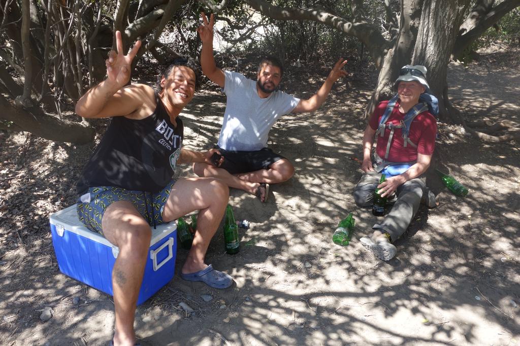
Just across the bridge, Bob found a couple of guys barbecuing chicken pieces and drinking beer. They were very sociable, and even though Bob doesn't speak Spanish, he managed to strike up a friendship using mime and English words. We hung out with them for a while, but I wanted to get out to the main road, where I figured we'd have better luck hitchhiking, so I dragged Bob away.
As it turned out, Bob was convinced that we could get a ride from these two guys — he said that they were a bird in the hand, and he had a connection with them. I was more concerned about the numerous empty liter beer bottles at their little campsite, and I felt that we could get a better deal at the main road. In the end, we turned around and went back.
The two guys were happy to see us. They gave Bob a cold liter bottle of Heineken and invited us to join them. I used my garbled Spanish to try to explain our situation, and they said that they were planning to leave by 4 PM anyway. In fact, we could leave earlier if we wanted, as soon as Bob finished his beer.
Bob actually wasn't that enthusiastic about the beer, and it was a bit of a comedy of errors as I tried to hint to Bob that he needed to drink up before these guys finished yet more bottles of their own. I tried to help — I don't like beer at all, but I was out of water and it was certainly cold.
When we were finally ready to leave, I counted 7 empty liters, not counting Bob's bottle. We threw the trash in the back of the guys' pick-up, and Bob and I squeezed into the jump seat with our packs in our laps. We took off in a cloud of dust toward Rancagua.
In fact, we bounced at such a high speed down the main dirt road that we caught the attention of the carabineros (police), who pulled us over. Everyone, including Bob and I, had to show ID. The carabineros weren't particularly interested in us after checking us for our PDI papers, so we waited in the car while they separately chatted with the driver and his friend. The driver got some sort of abbreviated sobriety test, which he appeared to pass, much to my amazement.
After that, we did drive a bit slower. The driver and his friend broke out another liter of Heineken to celebrate their narrow escape. When we reached the junction of the Río Pangal with the main Río Cachapoal, we turned off on a side road and began climbing a hill. The driver was a bit sloppy on the curves, and we went off the shoulder a couple of times; we hit a rock once, but it didn't do any (additional) damage.
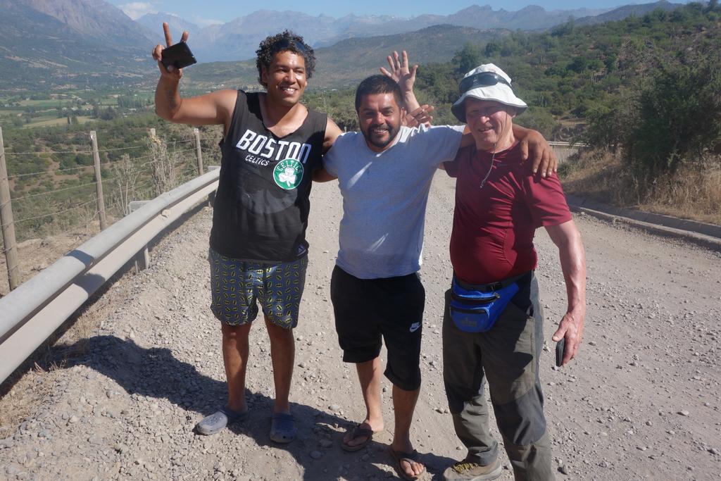
It turned out that they wanted to show us a nice viewpoint over the Cachapoal Valley at the top of the hill. We stopped, and Bob and I got out and took photos. We did some fun arm-in-arm buddy photos, and the guys pulled out another cold beer to celebrate. I did wonder whether we took a back road at least partly to avoid more encounters with carabineros.
We continued down the west side of the hill on more switchbacks. I was a bit relieved when we reached pavement near Termas de Cauquenes. On the other hand, that was also the scene of the most startling part of the drive. A bus that we were tailgating slammed on its brakes when a car tried to park on the shoulder in a busy spot and the bus couldn't get around it. We all jerked forward as our driver slammed on our own brakes. Fortunately the bus's brakes and tires were pretty bad, and we all slid to a stop inches from each other, in a cloud of nasty-smelling black smoke.
When we got to the hotel, we celebrated again by taking buddy photos. Bob wanted to offer the guys some cash, and I tried to persuade them that it was gas money — they cheerfully refused to accept it, as I expected they would. I realized right away that we had another great travel story...
Of course the story wasn't over. Back in our hotel room, we called the English speaking agent who had arranged our car rental, and he in turn called up Europcar to explain the situation. We were on the phone frequently, trying to convince everyone that the car was undrivable and was in a location where it couldn't be winched onto a trailer. Europcar promised us a replacement vehicle and told us that they would be in touch tomorrow. The extra money for English language assistance turned out to be well worth the expense.
Day 7: Wednesday, 12/26: Replacement Car
So we had no car and we had to check out of the hotel. Our next stop was in San Fernando, 55 km to the south in the Colchagua Valley.
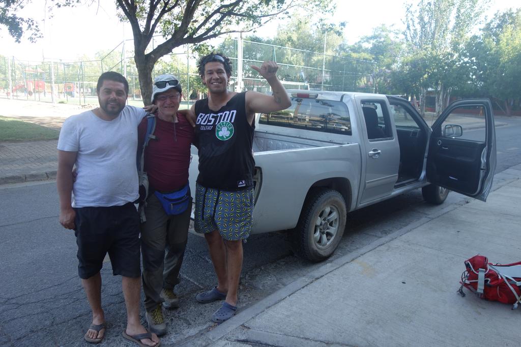
We ended up waiting around all day for a replacement car. I have a strong suspicion that the Europcar guys sent a tow truck and trailer up the Cachapoal Valley, just to see whether we were telling the truth. In any event, they didn't retrieve the Tiguan, and they didn't come up with a replacement vehicle until about 4 PM. We took a taxi over to the Europcar garage, where we discovered that no one spoke English. After I realized that my “Spanish” was basically incomprehensible to everyone there, we called up our English speaking agent again and he got things straightened out for us.
Europcar gave us a diesel Toyota HiLux 4WD pickup with a manual transmission. This was a “higher category” (more expensive) than the Tiguan, and much, much larger. It had less interior space, however; oh well. When we got back the hotel to collect our bags, I realized that this monster was going to be a serious pain to park, and so it was, for the rest of the trip.
We made it to San Fernando by 5:45 PM, which I thought was a pretty good time. San Fernando is not a tourist town — its neighbor to the west, Santa Cruz, gets all of the attention. San Fernando may be rough at the edges, but it's also pretty lively — the streets and sidewalks were crowded with shoppers on an pleasant evening. Bob and I had dinner in town at a tiny restaurant named La Trilogía. They didn't have every dish on their small menu, but we appreciated their effort, and we got a decent view down to the main street, peering through a maze of overhead wires.
![/galleries/chile_2018_08_colchagua/008_[Thu_Dec_27_12:47:24_CLST_2018].thumbnail.jpg](../galleries/chile_2018_08_colchagua/008_%5BThu_Dec_27_12:47:24_CLST_2018%5D.jpg)
Day 8: Thursday, 12/27: Colchagua
I had originally planned the day in San Fernando as a break from hiking, but due to illness and adventures, we were getting more breaks than hikes. Since we were also waiting to find out when we could get our gear back, we were also a bit reluctant to stray too far. Hence we drove around to a few wineries.
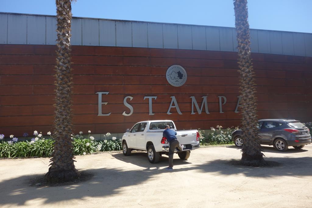
We headed out to Santa Cruz and stopped at the Estampa winery. The building was fancy, but the tasting room was cozy and more modest. Estampa prides itself on its blends. I really liked their viognier / chardonnay blend and I picked up a bottle.
Our next stop was the Laura Hartwig winery. This winery was much more traditional in style, and even had an unused polo ground in front. Of the wines that we tasted, I really liked their petit verdot, and I bought a bottle of it. I've never seen a straight petit verdot elsewhere; LH's treatment was very dark and rich.
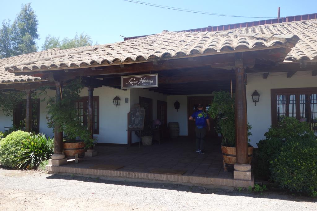
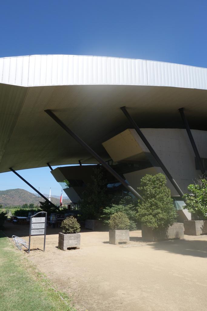
With time on our hands, I suggested that we drive the loop to the north and visit the Vik Winery. This side trip took much longer than I expected, with slow going on many little rural roads. We eventually managed to find the winery, and the architecture was as spectacular as advertised. We walked around the water sculptures at the main winery building. I was curious about the retreat at the winery, which looked like a gold and silver flying saucer perched on a hill, but it became apparent that like the San Pedro Winery, the Vik Winery was actually closed and we had managed once again to drive onto the grounds of a winery through a gate that had been left open accidentally.
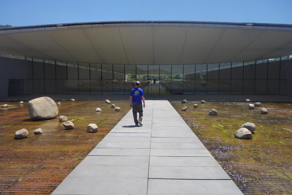
We checked in with Europcar and the Tiguan was still up on the mountain. Too bad. We drove on to our next stop, the city of Talca. Talca was very badly damaged by the earthquake of 2010 and signs of the quake are still fairly obvious. A number of buildings in the downtown area are abandoned and collapsing, with smashed windows, big cracks and graffiti. On the other hand, the town seems to be rebounding, and many buildings have obviously been repaired or rebuilt.
We were reluctant to drive even further from San Fernando without getting our gear back from the Tiguan, and we were getting especially concerned because the weekend was coming up and we expected Europcar to close through Tuesday for the long New Years holiday...
![/galleries/chile_2018_09_siete_tazas/009_Siete_Tazas_[Fri_Dec_28_15:47:15_CLST_2018].thumbnail.jpg](../galleries/chile_2018_09_siete_tazas/009_Siete_Tazas_%5BFri_Dec_28_15:47:15_CLST_2018%5D.jpg)
Day 9: Friday, 12/28: Parque Nacional Radal Siete Tazas
We were once again reluctant to go somewhere and miss out on a notification from Europcar that our gear had been retrieved, but it was just too nice a day to sit around. We decided to drive out to Parque Nacional Radal Siete Tazas in the Andes foothills northeast of Talca. Even the best route into the park requires you to drive 22 km on dirt. The HiLux performed very well; the clearance was admirable and the 4WD kept us from sliding around on mud.
The first real sight when you enter the park is the Cascada Velo de la Novia (Bridal Veil Falls). We took a few photos here and continued up the road. We crested a rise and guess what: Bob's phone got a cell signal and delivered a text message from Europcar saying that they had retrieved the Tiguan and we could pick up our gear if we could make it to Rancagua by closing time at 6.
I desperately wanted to see the highlight of the park, just a few kilometers up the road, but now we had a serious deadline. I sped up to the visitor center, paid the fee and sprinted to see the Seven Cups, a series of gigantic potholes in a narrow basalt gorge. I sprinted back and jumped in the truck, and we hurtled down the dirt road. The 4WD really paid off here.
That wasn't the end — we still had to drive miles of rural roads full of tractors and buses and bicycles, then join rush hour traffic on Ruta 5. But we made surprisingly good time, and by some miracle we arrived at the Europcar garage on the stroke of 6 PM. The Tiguan was parked just inside the doors, and all of our stuff was exactly where we'd left it. Success!
![/galleries/chile_2018_10_cascadas_del_maule/027_[Sat_Dec_29_12:44:30_CLST_2018].thumbnail.jpg](../galleries/chile_2018_10_cascadas_del_maule/027_%5BSat_Dec_29_12:44:30_CLST_2018%5D.jpg)
Day 10: Saturday, 12/29: Cascadas del Maule
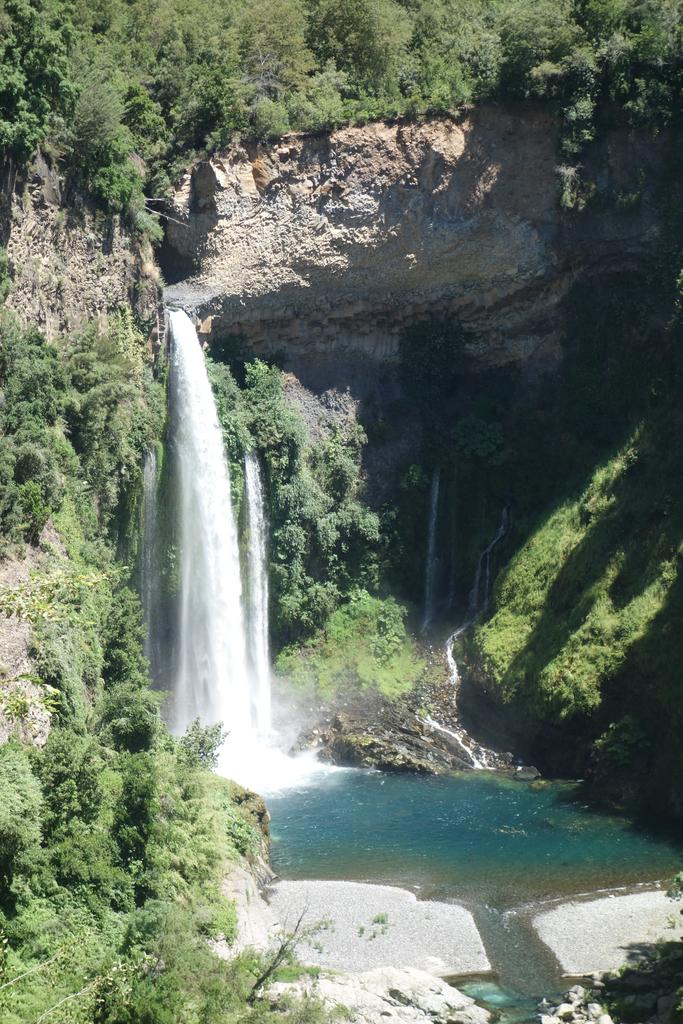
One of the hikes that I had been looking forward to was the Cascadas del Maule trail, a tour of several waterfalls along the upper Río Maule. You can see some of the waterfalls from the Río Maule road, but the trail runs along the gorge and gets you up close to the best stuff. The scenery along the road is fine too, and the road is paved all the way to the Argentine border.
The trail lived up to its billing — I took 75 photos. Yikes.
We got some great views of the famous Cascada Invertida (Inverted Waterfall). I hadn't really understood the name until we got right across from it and I realized that the fierce wind blasts up the valley every single day.
After doing the hike, we drove up the road with the idea that we might get a look at the Laguna del Maule, a large crater lake that is the source of the Río Maule. However, there is a customs station before you reach the lake, and we decided that we didn't want to struggle to explain to the agents that we weren't actually planning to drive into Argentina.
Day 11: Sunday, 12/30: Kidney Stone
Yes, I passed a kidney stone. I wrote up a long description of my ordeal but decided it was TMI. Ask me if you really want to know what it was like.
I'm going to be much, much more careful on subsequent trips to avoid getting dehydrated...
![/galleries/chile_2018_12_constitucion/008_[Mon_Dec_31_17:03:11_CLST_2018].thumbnail.jpg](../galleries/chile_2018_12_constitucion/008_%5BMon_Dec_31_17:03:11_CLST_2018%5D.jpg)
Day 12: Monday, 12/31: Constitución
I was in no shape for hiking, but I was feeling much better. By afternoon I was ready to drive around and check out wineries.
Once again, however, I'd managed to choose a really bad day to find wineries that would be open for visitors. Nobody really wants to be open on New Year's Eve. After striking out a couple of times, we asked someone where we might have better luck — they suggested Viña Balduzzi in San Javier, south Talca. Balduzzi was indeed open for tasting, and it was moderately busy.
Another winery that had been suggested to us was located off to the west in the coastal hills. It was closed, of course, but we decided that as long as we'd gone that far, we might as well drive to Constitución, a town on the coast at the mouth of the Río Maule. We made it there in reasonable time in spite of the fact that we had to stop every half hour so that I could take a leak in the bushes.
I was a bit surprised to find that the low mountains in the coast range are covered extensively by tree farms. There's very little native forest visible from the road — we saw instead huge groves of pines and eucalyptus. Even more surprising were the vast areas of blackened and burned trees, a product of recent monster wildfires.
Constitución, like Talca, had suffered badly in the big 2010 earthquake. It was interesting to see how the city had adapted along the waterfront, where the tsunami had wiped out neighborhoods. We drove out to Piedra de las Ventanas (Window Rock) on the furthest point of land on the south side of the estuary. It was windy and chilly, and we could smell the stench of the huge pulp plant just across the road.
Returning late to Talca, we discovered that the hotel restaurant was reserved for a pricey New Years Eve party. We walked around the neighborhood looking for restaurants that were open, but it was a wasteland. We'd given up and were heading back when we passed a Chinese restaurant with lights on. It was the Perla Azul (Blue Pearl) Restaurant, and they were open. We'll be forever grateful!
![/galleries/chile_2019_13_nevados_de_chillan/011_Nevados_de_Chillan_[Tue_Jan_1_17:08:15_CLST_2019].thumbnail.jpg](../galleries/chile_2019_13_nevados_de_chillan/011_Nevados_de_Chillan_%5BTue_Jan_1_17:08:15_CLST_2019%5D.jpg)
Day 13: Tuesday, 1/1: Nevados de Chillán
It was time to move on. Our next stop was Los Ángeles, a town that Google Maps occasionally confused with the more famous American city.
I was feeling so much better at this point that I was willing to try a hike. I checked Google and found a reasonably short hike on the way to Los Ángeles, in the resort area of Nevados de Chillán. The trail was only 6.4 km out and back, with 400m of elevation gain; I felt that I could handle that distance.
As it happens, the distance and elevation gain on that web page were way off — another web page that I looked at later gave the round trip distance as 11.6 km and the elevation gain as 800m, and that seems a lot more accurate to me. By the time we got back to the trailhead, I was hurting pretty badly.
On the positive side, it was a very pretty trail on a very nice day. Until you reach the Refugio Garganta del Diablo, you are walking mostly in native coigue forest, with some huge old trees and many different kinds of birds. (Bob pointed out to me a female carpintero negro, a large red-and-black woodpecker.) The trail climbs brutally steeply to a plateau, then wanders gradually uphill toward treeline, where it pops out at the foot of the Garganta del Diablo (Devil's Throat), with the refugio scenically posed on the skyline to the south.
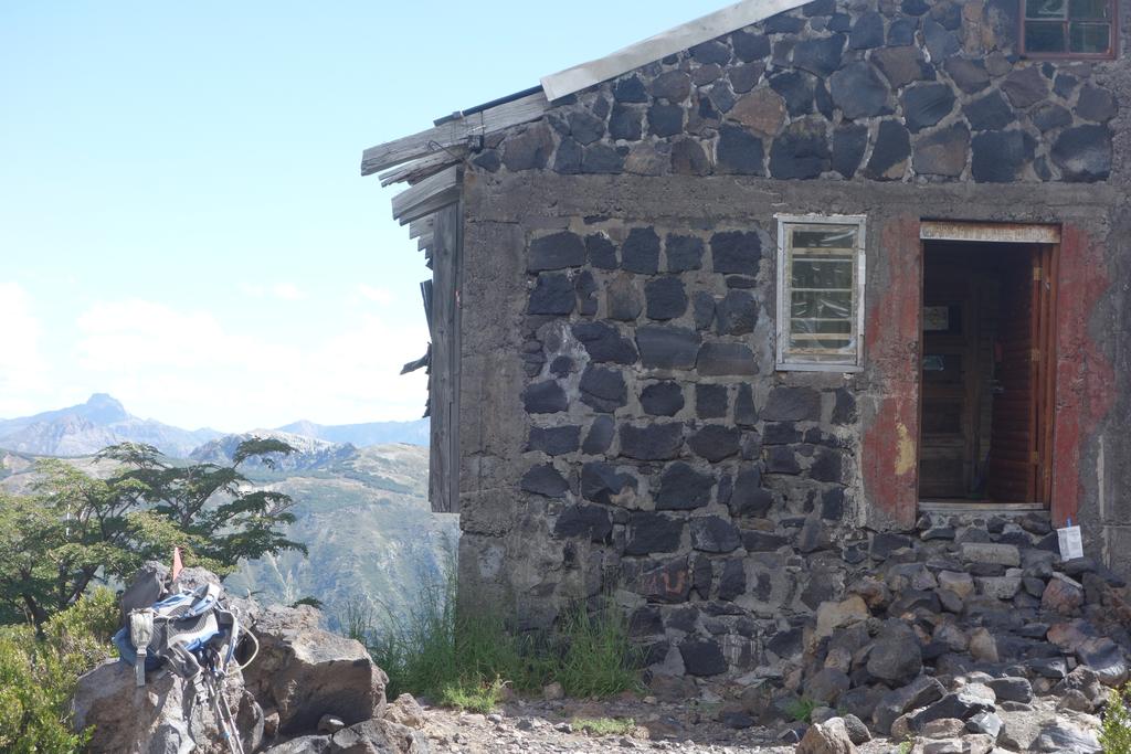
The refugio could use some TLC. Bob was speculating about how it was built and what could be done to it to make it usable. A volunteer group has been trying to maintain the building, but it's got a long way to go.
Day 14: Tuesday, 1/2: Stuck
Another sick day for me. I'll spare you the TMI details.
![/galleries/chile_2019_15_sierra_velluda/015_cobwebs_[Thu_Jan_3_14:00:51_CLST_2019].thumbnail.jpg](../galleries/chile_2019_15_sierra_velluda/015_cobwebs_%5BThu_Jan_3_14:00:51_CLST_2019%5D.jpg)
Day 15: Thursday, 1/3: Sierra Velluda
One of my goals in booking Los Ángeles was to get a chance to do the Sierra Velluda hike at Parque Nacional Laguna del Laja (Slab Lake National Park). I was happy to be feeling better and eager to get started.
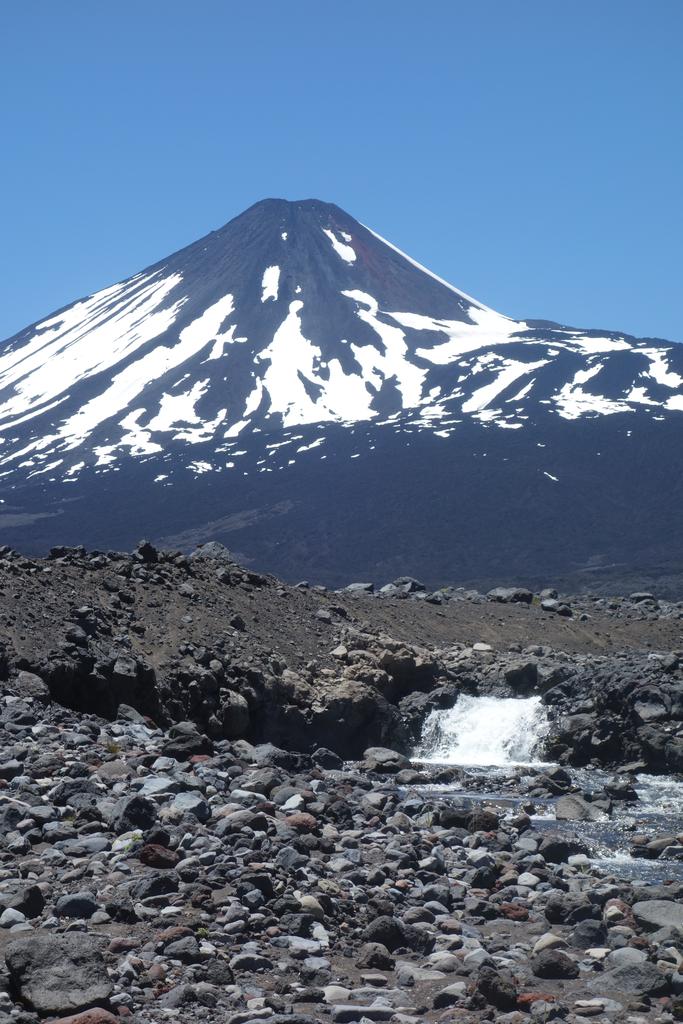
The park is famous for its two mountains: Volcán Antuco (2979m), a classic active volcanic cone, and Sierra Velluda (3585m), a heavily dissected and glaciated extinct volcano. I was charmed by how they look so distinct, even though they are neighbors. The park is also famous for its lake, Laguna del Laja, formed when a lava flow from Antuco dammed the Río Laja.
Somewhat oddly, the view of Sierra Velluda disappears when you enter the park. I was a little skeptical as we headed up the trail, which switchbacks up a huge lateral moraine. We got to the top of the hill and the spectacular ridge came into full view. We then had to cross a rugged lava field and a mud flat to reach the base of the cliffy north face of the peak, which in summer is decorated with many thread-like waterfalls.
The mountain is just mesmerizing. It doesn't look real at first — all this water and ice coming right after a totally barren and black lava flow. As I stared at it, I could pick out more and more misty waterfalls and spiky crags and narrow crevices. Fortunately there's little to stumble over when crossing the mudflat. We did discover that the outflow from the waterfalls creates fast-moving channels that block access to the cliff face. We weren't prepared to wade through the icy cold water, so we settled for lunch on boulders a hundred feet away.
After the hike, we drove further up the road to see the lake. It's a very large lake, blue and shining in the afternoon sun. I was a bit surprised that the ubiquitous hydropower companies had not built up a huge dam at the outflow, but it became apparent after studying the natural dam that the lake doesn't flow over the top of it. The water comes out through caves or fissures near the bottom of the dam. I discovered later that a hydro company drilled a tunnel through a mountain to take water from a different part of the lake.
![/galleries/chile_2019_16_laguna_verde/014_[Fri_Jan_4_13:39:40_CLST_2019].thumbnail.jpg](../galleries/chile_2019_16_laguna_verde/014_%5BFri_Jan_4_13:39:40_CLST_2019%5D.jpg)
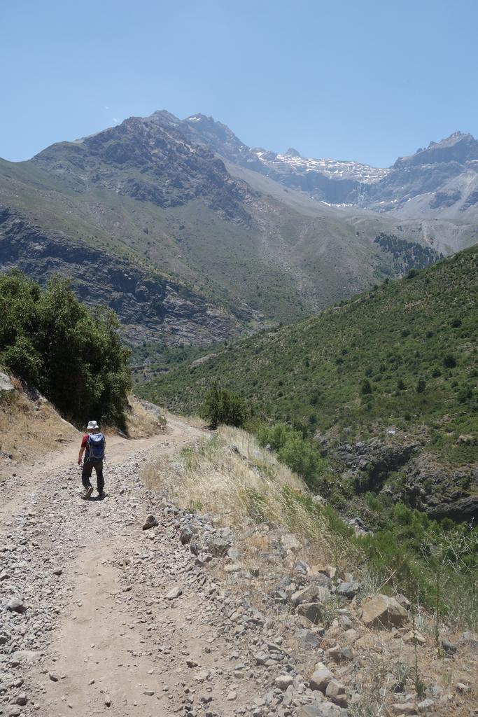
Day 16: Friday, 1/4: Laguna Verde
We were moving on to Pucón, but we didn't want to waste a day (by not hiking), so I found a hike for us in Parque Nacional Tolhuaca near Curacautín. We had to drive a fair distance on dirt, but until just before you reach the park boundary, the road is in excellent shape (and it's not too bad after that).
The hike starts with an attractive waterfall, then climbs gradually across a slope through dense forest, eventually reaching the lake, which is in a hanging valley. We met a trail crew installing signs that give the remaining distance to the lake.
The pehuén (monkey-puzzle) trees are one of the big highlights of the hike. They like ridges and summits — when looking across the valley, we could see them outlined on the cliff-edge.
After the hike, we drove to our Airbnb rental in Pucón. We had huge burgers for dinner at Beerhouse on Urrutia.
![/galleries/chile_2019_17_lago_toro/013_Lago_El_Toro_[Sat_Jan_5_15:28:58_CLST_2019].thumbnail.jpg](../galleries/chile_2019_17_lago_toro/013_Lago_El_Toro_%5BSat_Jan_5_15:28:58_CLST_2019%5D.jpg)
Day 17: Saturday, 1/5: Lago El Toro
We drove over to Lago Tinquilco in Parque Nacional Huerquehue with the idea of hiking to the high lakes (Lago Chico, Lago El Toro, Lago Verde). The winding dirt road up to the trailhead didn't seem to be heavily used, so it was a bit of a shock to reach the CONAF office and realize that there were hundreds of cars parked there. We elected to drive the somewhat-rougher 2 km further to an area of private buildings, where we paid a CLP$2.000 parking fee to an energetic 8-year-old girl.
We passed dozens if not hundreds of people on the way up the trail. The trail has switchbacks, but it's still fairly muddy and quite steep. We stopped at a couple of nice waterfall overlooks, where we saw yet more tourists. I was impressed at how many people actually made it to the upper lakes. Lago Chico and Lago El Toro were very pretty, with granite cliffs that dive into the water, and lush forest.
Lago Verde was not as scenic, and was absolutely jammed with tourists. There were a couple of young women who took out a cheap drone and flew it over the crowd. Bob and I blew on past — there were so many people, it was a bit hard to find a place to stand.
I had a fantastic steak for dinner at La Maga Parrilla Uruguaya on Urrutia. Bob had grilled chicken and a huge salad, but he should have tried the steak!
![/galleries/chile_2019_18_pucon/009_Pucon_beach_and_Lago_Villarrica_[Sun_Jan_6_14:28:24_CLST_2019].thumbnail.jpg](../galleries/chile_2019_18_pucon/009_Pucon_beach_and_Lago_Villarrica_%5BSun_Jan_6_14:28:24_CLST_2019%5D.jpg)
Day 18: Sunday, 1/6: Pucón
Bob hiked Volcán Villarrica on a guided tour with Mawida Adventures. You're required to use a guide service — apparently the local authorities got tired of rescuing independent climbers. Mawida provides all of the necessary equipment, although Bob had brought plenty of his own gear. A paved road takes you to the ski resort at 1400m elevation; if the lifts are running, you can cut 600m off of the 1487m ascent, but in Bob's case, the lifts were shut down and his group had to hike the entire elevation on crappy volcanic rock and on snow. The descent is a long butt glissade.
I wasn't in shape for that kind of hike, and I'm not very fond of snow. Instead I walked around Pucón and took pictures of the Lago Villarrica waterfront area. I also worked on booking accommodation for the rest of the trip.
We had dinner at Fiorentini, an Italian restaurant on O'Higgins. The red and black fresh pasta with seafood was really good.
Day 19: Monday, 1/7: a rain day in Pucón
Not too much to say; we did laundry. I'm writing up an entry mainly to mention the two places that we went to eat.
We enjoyed a lazy afternoon at the Cafe de la P on the corner of O'Higgins and Lincoyán. They have a counter in the back with loads of truffles and delicious alfajores (sugar cookies topped with a cone of dulce de leche and dipped in chocolate). Their hot chocolate was great too. We went to Raices on Fresia for dinner. It was nice, but not that memorable (meaning that I don't remember what I ate!).
Day 20: Tuesday, 1/8: a second rain day in Pucón
We picked up laundry. I finished reading a novel.
It was cold and wet and windy when we went to dinner at the Italian restaurant Andiamo on O'Higgins. I believe I had the gnocchi and liked it a lot. I love gnocchi!
![/galleries/chile_2019_21_panguipulli/012_Lago_Panguipulli_[Wed_Jan_9_19:05:57_CLST_2019].thumbnail.jpg](../galleries/chile_2019_21_panguipulli/012_Lago_Panguipulli_%5BWed_Jan_9_19:05:57_CLST_2019%5D.jpg)
Day 21: Wednesday, 1/9: Panguipulli
It was finally time to leave Pucón. The weather was still cool and wet. I wanted to drive out to Liquiñe to check out the scenery, so I concocted an elaborate route where we drove west to Villarrica and then cut southeast to Licanray and Coñaripe on Lago Calafquen before heading east on the Liquiñe road.
Bad news, though. The road was nominally paved, but all of the pavement was ripped up between the main bridge on the Coñaripe side and the Neltume turn-off. There were at least 3 long sections with waits for one-way traffic to clear. The mud and potholes were impressive. I couldn't believe that there were still buses plying the route between Coñaripe and Liquiñe.
Although the pavement started again at the Neltume intersection, we'd had enough, so we headed south past Lago Neltume. Most of this road is dirt / mud, although there are short paved sections at the north and south ends. The views were very pretty over the lake.
Our Airbnb rental in Panguipulli was somewhat rustic. It had a nice location just up the hill from downtown. It was very quirky, starting with the parking — we crammed our HiLux through the iron gate with centimeters to spare on either side, and we parked just a meter from the front doors of the units.
The hot water system was (um) interesting. It appeared to be on-demand hot water, but the flow with the shower faucet completely open was just barely enough to make the heater trigger. If I turned the water temperature down from scalding, then the heat turned off completely and I got icy water instead.
I later figured out that I could run the sink tap and the shower at the same time, and with the two of them together, I could keep the heater on without being forced to use a scalding temperature in the shower. The water flow in the shower wasn't great, but at least I wasn't burning myself!
One nice feature of the unit was that we were easy walking distance from the Mirador restaurant, one of the best in Panguipulli. The food and the hospitality were great, and the views over Lago Panguipulli were spectacular (true to their name).
It was here that I first noticed the bandurrias (black-faced ibises). They are handsome and large birds, and they fly by in staggered arrangements like fighter jets at an air show. They must have somehow reminded someone of the musical instrument called a bandurria, a mandolin-like instrument from Spain.
![/galleries/chile_2019_22_volcan_mocho/014_Mocho_and_ski_lodge_[Thu_Jan_10_14:28:13_CLST_2019].thumbnail.jpg](../galleries/chile_2019_22_volcan_mocho/014_Mocho_and_ski_lodge_%5BThu_Jan_10_14:28:13_CLST_2019%5D.jpg)
Day 22: Thursday, 1/10: Volcán Mocho
We drove out to Volcán Mocho, at the head of Lago Panguipulli. The lake views were amazing. It turns out that CONAF is busy rehabbing the entire area to turn it into a hiking destination. They have a long way to go, but we were shocked to get to the top of a long series of muddy switchbacks in temperate rainforest and discover a visitor center under construction with lots of new trails (also under construction).
We hiked the rough road from the Río Blanco bridge to the old ski resort. We could see fresh snow on the surrounding hills. To get to the summit of the volcano, you have to cross glaciers; I wasn't prepared to do that, but it looked like a fine hike.
We ran into (3 generations of) a German family who live in Liquiñe. Liquiñe is famous for its hot springs resorts — I didn't catch what the family does, but I assume that they own or run a resort. One of them mentioned that last winter, a landslide cut the road (and the power) for a week. These folks had been to the top of the volcano before, and gave us a description of the route.
After the hike, we drove out to Puerto Fuy on Lago Pirihueico. It was jammed with people; I was quite surprised. There was no place to park, so we turned around and drove back to Panguipulli.
![/galleries/chile_2019_23_cerro_mayo/016_Lago_Ranco_from_the_Cerro_Mayo_trail_[Fri_Jan_11_14:10:38_CLST_2019].thumbnail.jpg](../galleries/chile_2019_23_cerro_mayo/016_Lago_Ranco_from_the_Cerro_Mayo_trail_%5BFri_Jan_11_14:10:38_CLST_2019%5D.jpg)
Day 23: Friday, 1/11: Cerro Mayo
We moved on from Panguipulli, heading to Lodge El Taique outside Puyehue National Park. Once again we took the scenic route, and once again we took the opportunity to go hiking. We drove down the east side of Lago Ranco, a vast lake surrounded by gorgeous green countryside. On the southeast end, we turned off on a steep and winding dirt road along Estero Pitreño into Parque Futangue. We paid an entrance fee to this private park at a cabin, then continued up to the trailhead parking area.
The park has put in a lot of effort to make the Cerro Mayo trail work even though it's on a steep hill in thick, wet forest. The lower part of the trail is wide with a fairly gentle grade, passing by native trees that occasionally have signs identifying the species. Eventually the trail narrows and starts climbing quite steeply up steps that are reinforced with wooden slats and planks. The trail wends its way north and east out of the Pitreño valley and comes out above the cliffs on the north face of Cerro Mayo. There is a dead forest near the summit — we debated about whether it was weather or volcanic ash that stripped the trees.
The view on top is stunning. Not only is the lake big and blue and attractive, but you can see all the way to Volcán Mocho in the north and to Volcán Puyehue to the south, with a spectacular snow-capped ridge of granite peaks to the east along the international border.
![/galleries/chile_2019_24_lodge_el_taique/005_Lago_Rupanco_[Sat_Jan_12_21:26:45_CLST_2019].thumbnail.jpg](../galleries/chile_2019_24_lodge_el_taique/005_Lago_Rupanco_%5BSat_Jan_12_21:26:45_CLST_2019%5D.jpg)
Day 24: Saturday, 1/12: Termas Aguas Calientes
Lodge El Taique is a bit more upscale than the places we'd been staying, but I got a discount on booking.com that let us enjoy it without feeling too guilty. The lodge is in the countryside south of Lago Puyehue, with a wonderful view out over Lago Rupanco toward Volcán Puntiagudo and Volcán Osorno. It is run by a friendly French couple, who make some really great food. The interior design is lovely too, with stone and wood and glass that fit in nicely with the surrounding forest and fields.
This was a rain day. We went to Termas Aguas Calientes, a hot springs resort that is a (much) cheaper alternative to Termas de Puyehue just down the road. We soaked in the public pool, which was fairly crowded.
![/galleries/chile_2019_25_volcan_casablanca/018_Bob_with_Volcan_Casablanca_in_the_background_[Sun_Jan_13_14:53:19_CLST_2019].thumbnail.jpg](../galleries/chile_2019_25_volcan_casablanca/018_Bob_with_Volcan_Casablanca_in_the_background_%5BSun_Jan_13_14:53:19_CLST_2019%5D.jpg)
Day 25: Sunday, 1/13: Volcán Casablanca
We had sunny weather, but inconveniently we needed to leave for Puerto Varas. I decided that we should leave our bags at the lodge, and head east into Parque Nacional Puyehue to hike to Cerro Mirador on the Chile / Argentina border.
This idea came up short when we learned at Chilean customs that the trail was closed. I'm not sure why it was closed — my Spanish wasn't good enough to figure it out.
I worked out a back-up plan: we drove down to Termas Aguas Calientes and then up the hill to the Antillanca ski resort on Volcán Casablanca. Unlike the forest of the surrounding area, the peaks around Volcán Casablanca are bare due to geologically recent eruptions, so it was relatively easy to go cross country from the ski resort to a 1687m sub-peak on the ridge. I say “relatively” because it was a steep slog up loose cinders, with snow cornices at the top. The actual summit of Volcán Casablanca was too far away (and too snowy) for us to tackle given that we needed to take off for Puerto Varas.
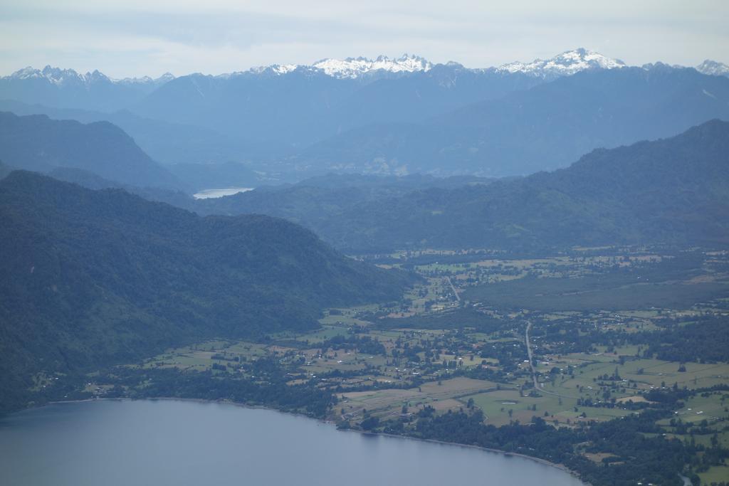
We picked up our bags and hustled. We actually made reasonable time even though we followed back roads from Entre Lagos south to Puerto Octay and Frutillar, on Lago Llanquihue. The lake is huge and beautiful; the road runs along the top of the massive terminal moraine on the west side. It eventually meets the Ruta 5 freeway, which we followed to Puerto Varas.
Google Maps had a terrible time finding our Airbnb rental home on the west side of town. I eventually made a lucky guess about the location, behind an iron gate at the end of a ridiculously narrow lane full of awkwardly parked cars and stray dogs.
We had dinner at Donde El Gordito, a hole-in-the-wall seafood restaurant on the corner of Del Salvador and San Bernardo. I thought that they were really good. I especially liked their seafood chupe, which is not what you might think from Google Translate — the name is probably adapted from soufflé, and it's a lot like crab mornay.
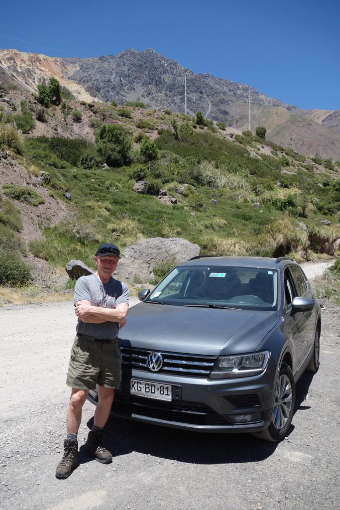
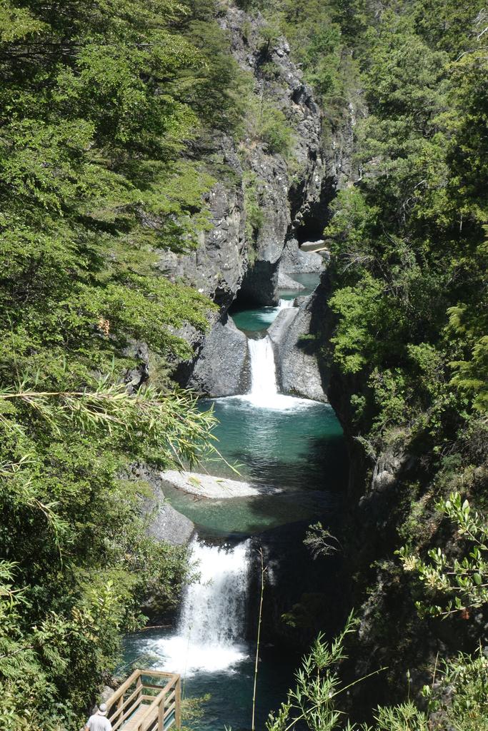
![/galleries/chile_2019_26_salto_petrohue_and_lago_todos_los_santos/009_Volcan_Osorno_looms_over_Petrohue_falls_[Mon_Jan_14_12:49:18_CLST_2019].thumbnail.jpg](../galleries/chile_2019_26_salto_petrohue_and_lago_todos_los_santos/009_Volcan_Osorno_looms_over_Petrohue_falls_%5BMon_Jan_14_12:49:18_CLST_2019%5D.jpg)
Day 26: Monday, 1/14: Saltos del Petrohue and Lago Todos los Santos
The Petrohue waterfalls are one of the highlights of Parque Nacional Vicente Pérez Rosales so of course the trail was packed with tourists. The waterfalls are still spectacular. Note that I did not shove any tourists over a railing in order to get a better photo.
Lago Todos los Santos appears to have formed when Volcán Osorno dammed the Río Petrohue. It's a deep blue lake surrounded by steep mountains. We took the Paso Desolación trail from the beach area near the outlet, working our way very gradually up to Mirador La Picada. The trail goes a long distance across lahar flows from Volcán Osorno; the forest was clearly destroyed repeatedly, leaving wide semi-bare areas with little islands of green. The bare areas were a perfect environment for the tábanos, the local flavor of horsefly. They circled Bob like biplanes attacking King Kong. Bob broke off a tree branch to use as a whisk, but it didn't seem to discourage them.
We had a very pleasant Italian dinner at Da Alessandro on the waterfront.
go to the Saltos del Petrohue and Lago Todos los Santos gallery
![/galleries/chile_2019_27_puerto_varas/011_Iglesia_del_Sagrado_Corazon_de_Jesus_and_Lourdes_shrine_[Tue_Jan_15_15:30:51_CLST_2019].thumbnail.jpg](../galleries/chile_2019_27_puerto_varas/011_Iglesia_del_Sagrado_Corazon_de_Jesus_and_Lourdes_shrine_%5BTue_Jan_15_15:30:51_CLST_2019%5D.jpg)
Day 27: Tuesday, 1/15: Puerto Varas
The forecast made the weather sound cold and wet. We stayed in town and I did laundry. Bob and I walked down to the waterfront and took pictures.
Of course the rain held off until evening. It poured while we dined at Las Buenas Brasas on San Pedro. I had a fantastic steak with (yes) crab sauce.
![/galleries/chile_2019_28_rio_chaica/005_Salto_del_Chaica_[Wed_Jan_16_12:23:07_CLST_2019].thumbnail.jpg](../galleries/chile_2019_28_rio_chaica/005_Salto_del_Chaica_%5BWed_Jan_16_12:23:07_CLST_2019%5D.jpg)
Day 28: Wednesday, 1/16: Río Chaica
We went to Parque Nacional Alerce Andino along the coast southeast of Puerto Montt. This was the soggiest rainforest that we'd yet seen, dripping wet after the previous night's storm. The lower section of the trail is very well maintained, with boardwalks and gravel fill to get around wet spots as it follows the river's north bank. At the big waterfall on the Río Chaica, there are even stairs and bridges, with a viewing platform at the El Milenario tree. The tree is an ancient alerce, a kind of cypress.
We kept plugging along, as the trail became less wonderful. Shortly we came to a “trail closed” sign. A bridge that crossed a tributary of the Río Chaica had washed out long ago, and the only way to cross was by hopping across slimy conical boulders and slimy decaying logs. We had lunch while deciding what to do; other hikers showed up and were also intimidated. While we were waiting, a couple of folks came from the other direction and crossed without incident. With that inspiration, a couple of women hikers crossed successfully, so we shrugged and crossed too.
The trail somehow managed to get even wetter and slipperier. We had to cross some big piles of wet logs. We could see traces of maintenance, where planks had been laid down to keep the trail above the mud. By the time we reached Lago Chaiquenes, the trail was mostly mud, roots and rocks. I had hoped to get as far as Lago Triángulo, but it was clear that the trail was a disaster — in fact there was yet another “trail closed” sign for people like us who didn't get the message after the first sign. We started up the trail, but it was hopeless — deep pools of mud, washed-out tree roots and deadfall made progress so slow that we'd never make it back to the trailhead by closing time if we continued.
The sun came out just as we got close to the trailhead, and we could finally see some of the peaks that surround the valley. While we stripped off our muddy boots in the parking lot, we saw a chilla (furry fox-like canid) come down from the CONAF office with an apple core in its mouth.
We had burgers at Vagli's on La Paz. They served a “Chiloé sour”, which turned out to be like a pisco sour but made with Chilote licor de oro, a liqueur made from fermented whey.
![/galleries/chile_2019_29_chiloe/028_Playa_Mar_Brava_[Thu_Jan_17_15:33:55_CLST_2019].thumbnail.jpg](../galleries/chile_2019_29_chiloe/028_Playa_Mar_Brava_%5BThu_Jan_17_15:33:55_CLST_2019%5D.jpg)
Day 29: Thursday, 1/17: Chiloé
We spent a day touring the northern tip of the big island of Chiloé. Chiloé is just 2.5 km from the mainland at its closest point, and there is talk of building a bridge. We took a car ferry, which was a lot of fun. You can see Volcán Yates and a long wall of snow-topped peaks in the distance to the east, and gentle green hills in the foreground on both sides of the strait.
We walked around the old town of Ancud, stopping at the even older Spanish Fort San Antonio and visiting the Museo Regional de Ancud. There are some really nice cultural displays at the museum, and it was fun to see their blue whale skeleton. Darwin stayed in Ancud while exploring Chiloé on the voyage of the Beagle; he observed a night eruption of Volcán Osorno.
There is a penguin sanctuary at Puñihuil on the west coast. The drive there was entertaining, with paved roads that were very narrow and twisty. When we saw the lines of tourists getting packed into the rafts for the penguin tours, we decided that we'd be good with just walking along the beach and checking out the tidepools.
Back in Puerto Varas, we had dinner at La Marca, a higher end steakhouse. I had another fantastic Chilean steak.
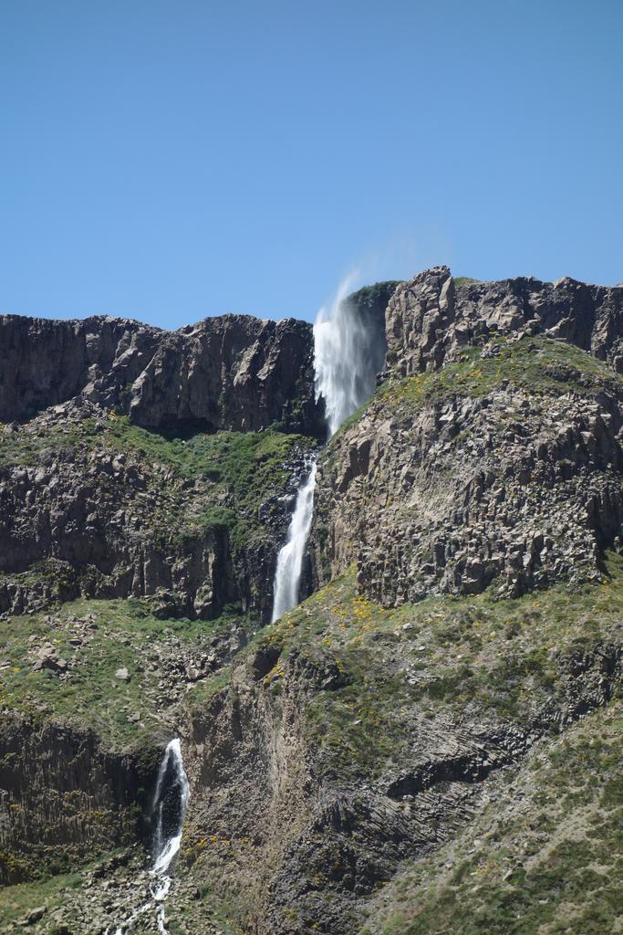
![/galleries/chile_2019_30_paso_desolacion/011_a_precarious_sign_on_Volcan_Osorno_[Fri_Jan_18_15:39:09_CLST_2019].thumbnail.jpg](../galleries/chile_2019_30_paso_desolacion/011_a_precarious_sign_on_Volcan_Osorno_%5BFri_Jan_18_15:39:09_CLST_2019%5D.jpg)
Day 30: Friday, 1/18: Paso Desolación
We had originally budgeted extra time in Puerto Varas to allow us to visit the Cochamó Valley, famous as Chile's answer to Yosemite. But it turns out that you need to backpack into the area if you want to see any of the best features, and we were't prepared to do that.
So on our last day of hiking, we went back to Volcán Osorno. This time we drove around to the north side and went up a dirt road to an abandoned ski area. This was incredibly scenic — pretty green farms with views out to vast Lago Llanquihue, all beneath the looming volcano. The end of the road is the Cafe de Thomas, a rustic shack in the middle of nowhere that offers cold drinks (including beer). The proprietor showed us the difference between the tábanos and the slightly smaller blue biting fly. The tábanos are fairly slow and stupid, and rarely bite humans, but the other flies will zip right in and stab you without warning. This guy could pluck flies out of the air by their wings; I was very impressed.
Bob was not amused by his loyal retinue of tábanos as we climbed the hill to Paso Desolación. He made another fly whisk out of a branch; I had to keep my distance so as not to get smacked in the nose. The view at the saddle was great, but I realized that we could get an even better view by climbing the 200m or so to the top of the ridge just to the north. The view up there was gobsmacking amazing. We could see the bent nail of Volcán Puntiagudo poking up behind the jagged slabs of La Picada. Across Lago Todos los Santos, we could see the glaciers of Cerro Tronador, the extinct volcano that rises higher than everything else in the neighborhood at 3554m. And of course we could see all sorts of details on Volcán Osorno, including a bizarre waterfall and a peculiar sign on the slope with nothing obvious to motivate it.
Naturally we had to hike over to the sign to see what it was about. Getting to it was a small adventure; we had to go up and down and through a series of washed-out little gorges. The sign is hanging out over one such gorge, which is going to eat it before long. The sign is a warning from CONAF that you must register before climbing the peak and that you need the appropriate technical gear. When we got back down the cafe, the proprietor told us that there were a couple of climbers who were overdue — hope they made it down safely.
We ate at Mesa La Tropera, a large pizzeria on the water that was just crammed. We had to wait 20 minutes for a table, which was an unusual experience for us in Chile, since we tend to eat earlier than most Chilenos.
Day 31: Saturday, 1/19: Back to SLC
All good things must come to an end...
We dropped off the (filthy) HiLux at the Puerto Montt airport without a problem. We then flew to Santiago on Sky Airlines. I got a great view of the Andes from my east-side window seat. Bob spent the night in Santiago and flew home the next day, while I squeezed into a seat and flew home that night.
Of course, I picked up a cold that kept me miserable for the next 10 days. One of the joys of air travel!