Salt River Range 2021
![/galleries/salt_river_range_2021/020_cliffy_crest,_on_the_way_back_down_[Sat_Jul_3_12:31:32_MDT_2021].thumbnail.jpg](../galleries/salt_river_range_2021/020_cliffy_crest,_on_the_way_back_down_[Sat_Jul_3_12:31:32_MDT_2021].jpg)
For the 4th of July, I went looking for a place that wasn't in “extreme” or “exceptional” drought status and which hadn't burned over in the last few years. Those places are getting harder and harder to find — 98.2% of Utah is at those drought levels. I noticed that parts of southwestern Wyoming were only at “moderate” or “severe” levels, although they had experienced a few big wildfires. Digging deeper, I found that the high point of the Salt River Range, Mount Fitzpatrick (10,907 ft), hadn't burned, and photos of it looked very attractive. Even better, the trailhead was 41 miles from pavement and there was a fighting chance that we could get a campsite. I put a trip on the calendar.
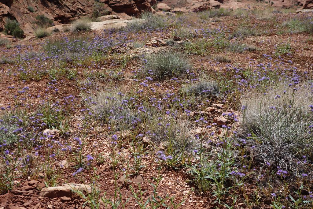
I took Friday as a vacation day so that I could leave early. I hooked up with Michelle in Wanship, and we caravaned into Wyoming, me in my 4Runner and Michelle in her Subaru pulling a teardrop trailer. The road in La Barge Creek was in reasonable shape except for a churned-up section near a ranch. We stopped for lunch at the Tri Basin Divide, marked by a sign that helpfully points in the directions of the three basins — south to La Barge Creek (Green River), north to the Greys River (Snake River) and west to the Smiths Fork River (Bear River). The three drainages don't quite meet; the Smiths Fork River headwaters are a mile or so away from the divide, but it's still pretty cool. The head of La Barge Creek was especially nice, with a vast carpet of yellow flowers.
The Greys River road drops through a very nice gorge before emerging into a big wooded valley. We could see wildfire scars on the east side of the road, but the west side was very green. We managed to claim a campsite less than a mile from the trailhead, with unburned trees and access to the river. Stanley, Paula and Craig all showed up before dark; what more could I ask for?
![/galleries/salt_river_range_2021/014_blue_and_green_waters_[Sat_Jul_3_11:12:53_MDT_2021].thumbnail.jpg](../galleries/salt_river_range_2021/014_blue_and_green_waters_[Sat_Jul_3_11:12:53_MDT_2021].jpg)
I was concerned about the possibility of monsoon rains on Saturday afternoon, so I twisted arms and got the crew to the Crow Creek trailhead by 7:30 AM. The grass was wet from dew as we set off. We crossed a footbridge over the Greys River and started up the trail into the Crow Creek valley, where we quickly ran into a problem. Crow Creek was running high and the trail wanted to ford it; could we avoid the ford? Yes we could, with a little bushwhacking and ingenuity involving streamside willows and a semi-floating log. After picking up the trail again, we walked through meadow after meadow full of flowers.
Mt Fitzpatrick seemed to sneak up on us. We came out of some woods and there was a massive cliff ahead. In fact, the cliff was so big it actually lifted Crow Creek up a hundred-foot step, blocking the valley with a cliff band. (I looked at a geological map later and found that a fault line runs along the base of this cliff; the mountains must be rising quickly, in mountain-rising terms.)
Near the foot of the cliff, we ran into the Way Trail, which runs north and south along the east side of the Salt River Range. We went north, climbing fairly steeply toward the north edge of the valley. The cliffs continued and access didn't look very promising, but we found a faint fork just a hundred yards or so before the crest. While we were checking it out, four dirt-bikers came across the crest of the trail and down past us — apparently this pristine-looking area is not wilderness.
We followed the side fork toward the cliff band, where it came to a weak spot and switchbacked steeply to a bench above the cliffs. The trail then traversed south into the middle of the hanging valley, where we found the first of the Crow Creek Lakes.
We took a snack break near the outlet of the lake. It's a very pretty lake, with deep blue water below striated gray cliffs. Snow patches came down to the water line. Craig joked that there was a dam at the outlet, and that's actually what it looked like — there was a bedrock shelf that the outlet had to cross.
It took a little while, but with some collaborative effort, we located a use trail a couple hundred feet above this first lake that headed west to the second lake. The trail faded in and out, but we were able to track it through the gorgeous upper basin. The upper lake had bathtub rings that indicated that the lake level was much higher earlier, but it was still a substantial lake. Huge rock glaciers came down to the lake from the south slope. To the west, we could see a pink-orange cliff band on the summit block. The summit approach looked moderately obnoxious: about 1300 ft of slogging up a steep talus pile to the ridge and on to the hidden peak.
We stopped for lunch at the foot of this final ascent. I studied the route and had the bad feeling that the numbers were not working out for a summit day. It was already after noon, and I figured that we had an hour and a half or two hours to the summit, then at least an hour back down, and then three and a half or four hours back to the trailhead. That could get us back down as late as 7 PM, and I could already see black clouds starting to collect in our neighborhood. Reluctantly, I decided that we should turn around and head back down.
Michelle's car thermometer read 85 degrees F on the ride back to camp. That was about 10 degrees higher than the forecasted high, and we were sweaty. Fortunately Michelle had scouted out a nice gravel bar on the near shore of the Greys River about a hundred yards from camp. We all trooped down there and took a dip. Very nice!
![/galleries/wyoming_range_2021/022_Michelle_and_Paula_heading_down,_with_white_flowers_on_the_left_and_elephants_head_on_the_right_[Sun_Jul_4_13:55:40_MDT_2021].jpg](../galleries/wyoming_range_2021/022_Michelle_and_Paula_heading_down,_with_white_flowers_on_the_left_and_elephants_head_on_the_right_[Sun_Jul_4_13:55:40_MDT_2021].jpg)
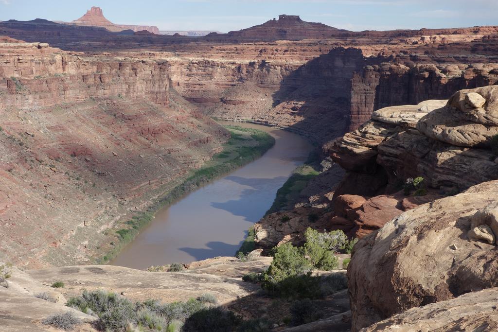
When I was looking at places to go hiking around the Greys River, I was a bit leery of hiking in the Wyoming Range because it looked like it had been badly damaged by two big fires (the Marten Creek fire in 2018 and the Fontenelle fire in 2012). It turns out that that a section between Wyoming Peak in the south and Box Canyon in the north was mostly spared from the fires. (Note that Google Maps' satellite view doesn't appear to show the more recent fire.) Box Canyon sounded pretty, so I picked it for Sunday's hike.
The trail stays mostly on the north side of the creek. The lower section goes up and down, alternating between thick streamside forest and dry meadowy slopes. There are a few sections where the trail cuts across huge rock glaciers. The slopes have cliffs, hoodoos and giant avalanche scars. At the junction between the north and south forks of the creek, the trail crosses the north fork and switchbacks steeply up the east wall, before cutting back to the north to reach the north fork again. We got glimpses of waterfalls and cascades in both forks, and the cliff bands came in pretty shades of pink, orange and purple.
Paula led the way into the headwaters of the north fork. We tramped through a flower-filled meadow to a lone signpost next to a lovely blue pond. The pond is the source of the north fork of Box Canyon Creek, and the sign points out the intersection with the Wyoming National Recreation Trail.
We took a snack break here and debated our next move. We agreed that the southbound stretch of the Wyoming Trail looked steep and snowy, while the northbound trail looked relatively gentle. We went north. At the crest of the ridge, we wondered whether we could beat the monsoon to the nearest bump on the main ridge, Peak 10590. The peak was only a mile or so away and the terrain looked pretty gentle, so we went for it.
It was pretty easy. We had to avoid a few lingering patches of slushy snow, but it wasn't much of a challenge. The clouds were developing more slowly than on Saturday, which was a relief. We dropped packs on the summit and enjoyed the view while eating lunch.
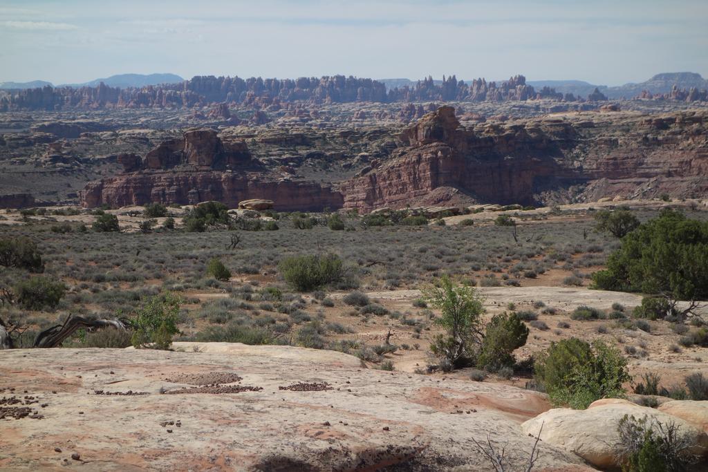
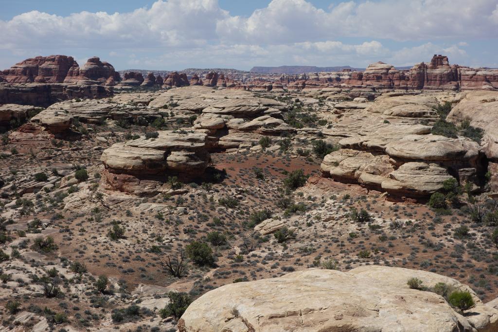
Box Canyon was a yawning gulf at our feet. We could see the big waterfall in the south fork, as well as the huge rock glaciers that fill its upper reaches. Further to the south, we could see the summit block of Coffin Peak. (I think you can just make out the pointy tip of Wyoming Peak in the photo that I took.) To the west, I was impressed by the spectacular wall of the high Salt River Range. It's spiky and cliffy and striped. The peaks in the Wyoming Range to the north seemed rounded and peaceful by contrast. Further to the north we could make out the Tetons, and off to the east was the shadow of the Wind Rivers. It was very nice to get on top of a peak after Saturday's disappointment.
We bathed in the river again in the late afternoon. That night, a very mild rainstorm drifted through. It wetted the roads, but the drive out on Monday wasn't particularly difficult. I was gobsmacked once again by the amazing flowers. All in all, a very fine trip with fine company!
![/galleries/dry_canyon_2021/015_triple_towers_[Sat_May_29_11:07:58_MDT_2021].thumbnail.jpg](../galleries/dry_canyon_2021/015_triple_towers_[Sat_May_29_11:07:58_MDT_2021].jpg)
![/galleries/noahs_ark_2021/005_cliff_bands_[Fri_May_28_16:16:58_MDT_2021].thumbnail.jpg](../galleries/noahs_ark_2021/005_cliff_bands_[Fri_May_28_16:16:58_MDT_2021].jpg)
![/galleries/dry_canyon_2021/017_at_the_dryfall_[Sat_May_29_11:36:03_MDT_2021].thumbnail.jpg](../galleries/dry_canyon_2021/017_at_the_dryfall_[Sat_May_29_11:36:03_MDT_2021].jpg)
![/galleries/second_left_hand_fork_2021/014_at_the_pour-off_[Sun_May_30_11:35:38_MDT_2021].thumbnail.jpg](../galleries/second_left_hand_fork_2021/014_at_the_pour-off_[Sun_May_30_11:35:38_MDT_2021].jpg)
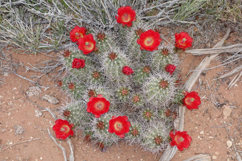
![/galleries/confusion_range_knoll_2020/001_precarious_cactus_[Fri_May_8_17:15:54_MDT_2020].thumbnail.jpg](../galleries/confusion_range_knoll_2020/001_precarious_cactus_[Fri_May_8_17:15:54_MDT_2020].jpg)
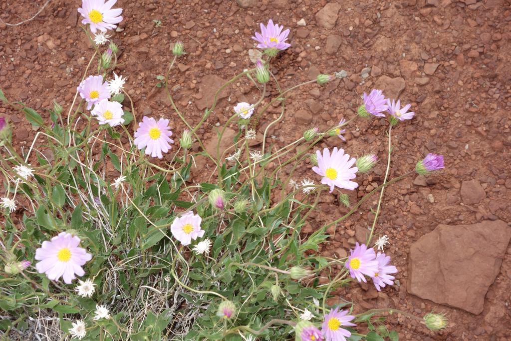
![/galleries/confusion_range_cat_canyon_2020/007_Erigeron_concinnus_[Sat_May_9_09:44:18_MDT_2020].thumbnail.jpg](../galleries/confusion_range_cat_canyon_2020/007_Erigeron_concinnus_[Sat_May_9_09:44:18_MDT_2020].jpg)
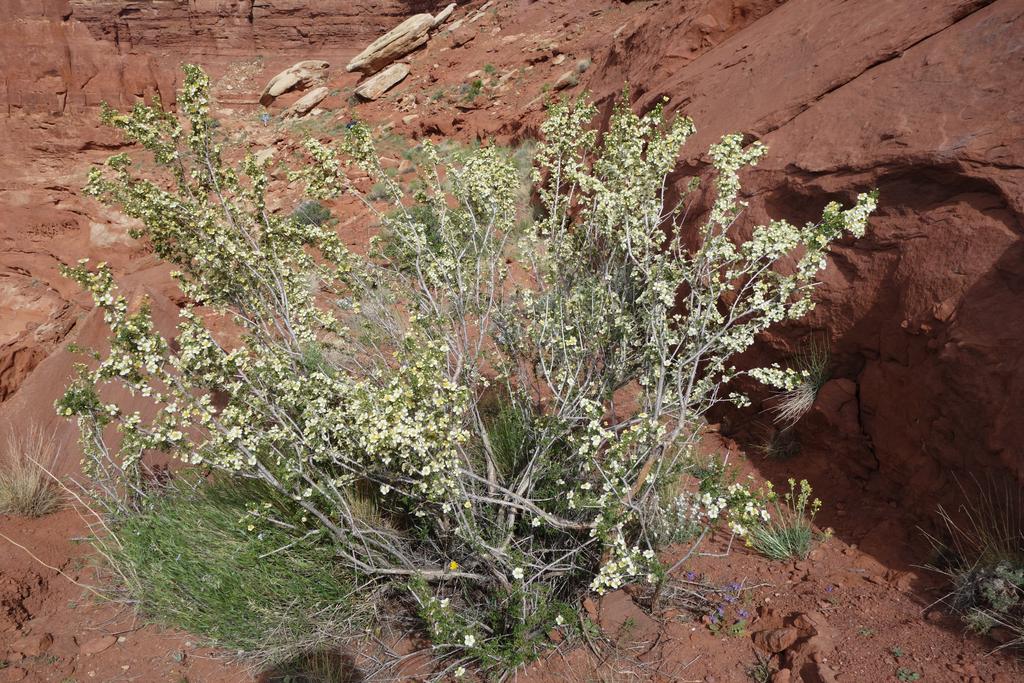
![/galleries/confusion_range_crystal_peak_2020/001_the_north_face_[Sat_May_9_12:52:23_MDT_2020].thumbnail.jpg](../galleries/confusion_range_crystal_peak_2020/001_the_north_face_[Sat_May_9_12:52:23_MDT_2020].jpg)
![/galleries/confusion_range_fossil_mountain_2020/004_on_the_dune_[Sun_May_10_10:11:24_MDT_2020].thumbnail.jpg](../galleries/confusion_range_fossil_mountain_2020/004_on_the_dune_[Sun_May_10_10:11:24_MDT_2020].jpg)
![/galleries/confusion_range_ibex_2020/008_a_country_of_ledges_[Sun_May_10_11:14:05_MDT_2020].jpg](../galleries/confusion_range_ibex_2020/008_a_country_of_ledges_[Sun_May_10_11:14:05_MDT_2020].jpg)
![/galleries/house_range_2019/009_Jerry_on_the_slabs_[Sat_Oct_19_10:50:12_MDT_2019].thumbnail.jpg](../galleries/house_range_2019/009_Jerry_on_the_slabs_[Sat_Oct_19_10:50:12_MDT_2019].jpg)
![/galleries/hearst_castle_2019/058_is_this_really_the_15th_century_[Fri_Sep_27_12:41:12_MDT_2019].thumbnail.jpg](../galleries/hearst_castle_2019/058_is_this_really_the_15th_century_[Fri_Sep_27_12:41:12_MDT_2019].jpg)
![/galleries/gbnp_mt_wheeler_mine_2019/007_Michelle_admires_the_twilight_[Fri_Aug_30_20:06:21_MDT_2019].thumbnail.jpg](../galleries/gbnp_mt_wheeler_mine_2019/007_Michelle_admires_the_twilight_[Fri_Aug_30_20:06:21_MDT_2019].jpg)
![/galleries/gbnp_mt_washington_2019/001_Michelle_and_Stanley_at_the_cliff_edge,_with_Wheeler_Peak_in_the_distance_[Sat_Aug_31_10:06:02_MDT_2019].thumbnail.jpg](../galleries/gbnp_mt_washington_2019/001_Michelle_and_Stanley_at_the_cliff_edge,_with_Wheeler_Peak_in_the_distance_[Sat_Aug_31_10:06:02_MDT_2019].jpg)
![/galleries/gbnp_wheeler_peak_2019/003_Stanley_below_Wheeler_Peak_[Sun_Sep_1_12:44:35_MDT_2019].thumbnail.jpg](../galleries/gbnp_wheeler_peak_2019/003_Stanley_below_Wheeler_Peak_[Sun_Sep_1_12:44:35_MDT_2019].jpg)
![/galleries/gbnp_lehman_caves_2019/022_Gaudi_cathedral_[Mon_Sep_2_12:23:50_MDT_2019].thumbnail.jpg](../galleries/gbnp_lehman_caves_2019/022_Gaudi_cathedral_[Mon_Sep_2_12:23:50_MDT_2019].jpg)
![/galleries/white_mountain_ridge_2019/019_Beth_and_Toby_work_their_way_down_toward_Baseball_Flat_[Thu_Jul_4_13:09:17_MDT_2019].thumbnail.jpg](../galleries/white_mountain_ridge_2019/019_Beth_and_Toby_work_their_way_down_toward_Baseball_Flat_[Thu_Jul_4_13:09:17_MDT_2019].jpg)
![/galleries/marys_nipple_2019/007_infinitely_many_spring_beauties_[Fri_Jul_5_11:27:56_MDT_2019].thumbnail.jpg](../galleries/marys_nipple_2019/007_infinitely_many_spring_beauties_[Fri_Jul_5_11:27:56_MDT_2019].jpg)
![/galleries/quitchupah_creek_rim_2019/004_Toby_on_the_plateau_[Sat_Jul_6_09:48:48_MDT_2019].thumbnail.jpg](../galleries/quitchupah_creek_rim_2019/004_Toby_on_the_plateau_[Sat_Jul_6_09:48:48_MDT_2019].jpg)
![/galleries/rainbow_canyon_2019/007_admiring_the_bees_at_the_mouth_of_the_lower_cave_[Fri_May_24_14:45:52_MDT_2019].thumbnail.jpg](../galleries/rainbow_canyon_2019/007_admiring_the_bees_at_the_mouth_of_the_lower_cave_[Fri_May_24_14:45:52_MDT_2019].jpg)
![/galleries/tuff_towers_2019/008_the_gates_[Sat_May_25_11:01:34_MDT_2019].thumbnail.jpg](../galleries/tuff_towers_2019/008_the_gates_[Sat_May_25_11:01:34_MDT_2019].jpg)
![/galleries/cathedral_gorge_2019/007_Mohamed_and_Steve_negotiate_a_corner_in_the_tunnel_[Sat_May_25_16:51:12_MDT_2019].thumbnail.jpg](../galleries/cathedral_gorge_2019/007_Mohamed_and_Steve_negotiate_a_corner_in_the_tunnel_[Sat_May_25_16:51:12_MDT_2019].jpg)
![/galleries/oak_springs_trilobites_2019/003_Tony_digs_deep_[Sun_May_26_10:13:58_MDT_2019].thumbnail.jpg](../galleries/oak_springs_trilobites_2019/003_Tony_digs_deep_[Sun_May_26_10:13:58_MDT_2019].jpg)
![/galleries/white_river_narrows_2019/006_petroglyphs_everywhere_[Sun_May_26_15:36:16_MDT_2019].thumbnail.jpg](../galleries/white_river_narrows_2019/006_petroglyphs_everywhere_[Sun_May_26_15:36:16_MDT_2019].jpg)
![/galleries/white_crack_1_2019/013_the_White_Crack_from_above_[Sat_Apr_27_11:07:25_MDT_2019].thumbnail.jpg](../galleries/white_crack_1_2019/013_the_White_Crack_from_above_[Sat_Apr_27_11:07:25_MDT_2019].jpg)
![/galleries/white_crack_2_2019/017_Bob_and_Craig_hold_on_to_their_hats_[Sun_Apr_28_10:57:03_MDT_2019].thumbnail.jpg](../galleries/white_crack_2_2019/017_Bob_and_Craig_hold_on_to_their_hats_[Sun_Apr_28_10:57:03_MDT_2019].jpg)
![/galleries/white_crack_3_2019/009_looking_down_the_crack_[Mon_Apr_29_09:58:46_MDT_2019].thumbnail.jpg](../galleries/white_crack_3_2019/009_looking_down_the_crack_[Mon_Apr_29_09:58:46_MDT_2019].jpg)
![/galleries/onion_creek_2019/009_wonderland_of_hoodoos_[Sat_Apr_13_14:06:28_MDT_2019].thumbnail.jpg](../galleries/onion_creek_2019/009_wonderland_of_hoodoos_[Sat_Apr_13_14:06:28_MDT_2019].jpg)
![/galleries/sego_canyon_2019/011_amazing_details_[Sun_Apr_14_13:49:52_MDT_2019].thumbnail.jpg](../galleries/sego_canyon_2019/011_amazing_details_[Sun_Apr_14_13:49:52_MDT_2019].jpg)