


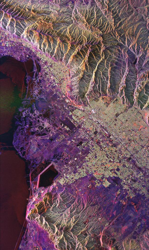


Xerox PARC Map Viewer
![[Xerox Map]](xerox.gif)
Some features of interest:
- Town of Dugway
- Located in the center of the map at the red marker. The single road leading to Dugway is a gravel road approaching from the east.
- Dugway Proving Ground
- The large military area in the southwest corner
- West desert bombing and gunnery range
- The large military area in the northwest corner
- Tooele Army Depot
- To the northeast of Dugway are two military areas comprising the Tooele Army Depot. This is where a significant fraction of the U.S. military's chemical arsenal is stored.
- Skull Valley Indian Reservation
- Small reservation immediately north of the town of Dugway
- Interstate 80
- I-80 traverses the southern end of the Great Salt Lake and north of the military areas.
- Great Salt Lake Salt Flats
- The Great Salt Lake is essentially what remains of an ancient inland sea. The lake is only a fraction of its original size, the ancient climate having changed from wetter to drier over time. As the lake evaporated, large salt flats were left behind. The soil and water are too salty for anything to survive except brine shrimp (also known as "sea monkeys"). This makes a nice, desolate area away from people for use in military training. The dotted line shows the boundary of the salt flats.
- Utah Lake
- Utah Lake, a tributary to the Great Salt Lake, is the large body of water immediately east of Dugway.