Pigeon Creek 2016

/galleries/pigeon-creek-2016/024_the_overhang_[Sat_Oct_8_14:30:19_MDT_2016].thumbnail.jpg

On the Little Black Mountain hike, Steve Duncan and I had talked about how lovely Maple Canyon is in the San Pitch Range, with its great fall colors and conglomerate cliffs. I realized on the way home that I had never checked out the conglomerate cliffs on the opposite (west) side of the range, in Pigeon Creek. I asked Jerry Hatch if he was interested in coming along to check it out with me, and he was up for it.

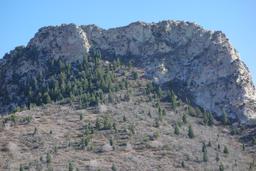
So on Saturday morning, we set off down the freeway to Nephi. We got off at the south Nephi exit and drove down SR 28 to Levan. From the intersection with SR 78, we went two blocks south and turned east on 100 South. We followed this road until the pavement ran out at a T intersection at the foot of the mountains, then turned north and east to get into Pigeon Creek. The maintained dirt road in Pigeon Creek is in fine shape. It runs up the canyon several miles to an informal campsite at a loop, where we parked below an imposing cliff band.

The good news is that the canyon is gorgeous. We hiked through glorious fall colors up through a narrows, passing by travertine pools and below red and buff conglomerate cliffs. We went a mile and a quarter up the main canyon, then veered off to the south to check out Mill Hollow. This brought us into a valley bounded on both sides by even more spectacular cliffs, with thick forest of white fir, aspen and rocky mountain maple. We ran out of time and turned around, taking lots of photos on the way back as well.

The bad news is that Pigeon Creek is an epic bushwhack. It took us 6 1/2 hours to go less than 5 miles round trip. While both the Forest Service map and the Garmin GPS map show a trail in Pigeon Creek, it hasn't been maintained in many decades, from what we could tell. We could make out the remains of a road on the south side of the creek, but it has been washed out in several places, perhaps due to overgrazing. We followed cow trails and game trails through the thick brush, sometimes climbing high above the stream to avoid big holes full of loose dirt and gravel. When we found the road, we made much better progress, but the forest is retaking the road and it takes vigilance (and imagination) to stay near it.

At the bottom of the narrows, we took a precarious route around the south side of a series of pools, alternating between crumbling slopes and patches of stinging nettle. After this section, we picked up the last vestige of the road just before the real narrows start. The water in the creek stopped here too, which was fortunate. In the narrows, we had to scramble over a number of big mossy boulders, but those were less of a problem than the mess in the following section, where we struggled with the deadfall and the thickets of cottonwood, dogwood and willow, with maple and mountain-mahogany thrown in for good measure. There are plenty of white firs too, but they were only a problem when they fell across the stream.

Above the narrows, there is a section where we were able to walk on a fairly pleasant bench on the north side, passing the bottom of Dry Canyon. This soon petered out and we ended up in a massive brush thrash leavened with big piles of cottonwood deadfall. After a while, this subsided a bit and we made reasonable time to the Mill Hollow fork.

The bottom of Mill Hollow was pretty, with conglomerate bedrock and lovely fall colors, but it rapidly degenerated into a steep thrash through dogwood, slippery boulders and deadfall. At one point we escaped east onto the slopes and bashed through maple brush for variety, before being forced back down into the dogwood. I discovered at one point that my sunglasses had been ripped off my head, and I spent a disappointing 20 minutes hunting for them in the leaf litter and mud.

Eventually the valley leveled out somewhat and we could follow a trickle of water up the stream, with digressions for big piles of deadfall. I wanted to get some good shots of the cliffs that walled in the valley, but the forest was so thick that it was hard to get a complete picture. When we stopped to get some last photos and drink water, I pulled off my pack and my sunglasses fell out. Lucky me!

The trip down was only a little less laborious than the trip up, and the only thing that kept my morale up was the fantastic fall color display. I was really grateful to see the car parked at the end of the road (and with no bullet holes in it).

go to the Pigeon Creek gallery


Montreal Hill fall 2016

/galleries/montreal-hill-2016/010_picture_perfect_[Sun_Sep_25_10:41:26_MDT_2016].thumbnail.jpg

I had scheduled a hike for Kessler Peak on September 25th, but a big storm passed through in the days before, and it dumped the first snow of the season on the peaks. I was concerned that getting up Kessler would be a steep, icy, muddy mess.

Fortunately Brad had a great idea — we could go up Montreal Hill instead. There is a road that goes most of the way up, so even under the snow, we could see the route and it wouldn't be too steep.

It was great. The sky was clear, the aspen were gorgeous, and some moose put in an appearance. I'd been waiting all season to see a moose — they were mysteriously elusive for me all season long.

Everyone in our group of 12 made it to the top. The view was spectacular. The fall colors were so amazing, I added a blog post to share them. Enjoy!

go to the Montreal Hill gallery


Dinosaur 2016

/galleries/dinosaur-split-mtn-2016/015_claws_[Sat_May_28_14:06:11_MDT_2016].thumbnail.jpg


I'd never hiked in Dinosaur National Monument, and I'd never seen the famous Dinosaur Quarry there. I decided that it was time to rectify that error and scheduled a WMC trip there for Memorial Day.


/galleries/dinosaur-split-mtn-2016/007_window_of_opportunity_[Sat_May_28_11:57:22_MDT_2016].thumbnail.jpg

I have driven past the amazing south wall of Split Mountain and wondered whether it would be equally cool up close. Surprise! It was.

I had a fantasy that I could scramble up to a gap in the wall and get an amazing view down to the Green River in the Split Mountain gorge. It may well be possible to do that, but it would take a full day of route finding. I have no regrets about turning around in time to visit the Dinosaur Quarry exhibit. (Now my fantasy is to camp at the Green River campground, start at 6 AM with just a couple of friends and head up the 5th major drainage east of the river!)

go to the South Split Mountain and the Dinosaur Quarry gallery


/galleries/dinosaur-johnson-cyn-2016/018_green_and_buff_[Sun_May_29_13:29:03_MDT_2016].thumbnail.jpg

Sunday was an adventure.

We left camp on Blue Mountain at 8 AM and drove down the impressive Echo Park Road to the Yampa Bench, then headed west to Johnson Draw. We stopped on the way at some impressive viewpoints over the Yampa River and its classic sandstone gorge. We parked at the Baker Cabin and headed downstream. (I noticed a car parked along the road across the draw, and I wondered whether we would meet anyone on the hike, but we never did.)

There is a track that we were able to follow a lot of the time in the canyon. The track is mostly used by cows now, but I'm guessing that it was originally a horse or foot trail. (It starts a bit west of the Baker Cabin side road.)

After we reached the main section of Johnson Canyon, we soon found an alcove with pictographs and petroglyphs (and piles of cow poop). The canyon was cool and shady, with lots of box elders and cottonwoods. The bad news was that as the canyon got deeper and narrower, the brush got more obnoxious and it was more difficult to find the faint track.

We celebrated when we reached the Yampa gorge. It was full of cold brown water from the Rocky Mountains' spring melt. We visited some more pictographs along the river bank, then started back up the canyon. We were concerned that we might roast in the warm sun on the climb, but clouds moved in and shaded us. This weather made me a bit worried, though, and we zipped on back to the cars without any of my planned diversions. We got sprinkled on but there was no real rain, to my relief.

We headed back west toward Echo Park. Everything was fine until just after the Castle Park overlook. It was clear that a storm had passed through. I could hear mud splattering onto my fenders, and I crossed my fingers that the road was going to stay drivable.

But within a hundred yards, I completely lost control of my steering, even in 4WD with traction control. There was no way we were going to go forward; I carefully made a 3 point turn and headed back very slowly, hoping to intercept Stanley in his 4WD pick-up before he got in trouble.

Too late. Stanley's truck was spinning all 4 wheels with a locked differential, and he was in grave danger of sliding into a ditch. With some pushing from passenger Keith, he managed to get aligned so that he could do a 3-point turn by getting off the road on the high side, where the wet sand had better traction than the wet clay on the road.

I'm still cursing myself for not getting pictures... Gaah!

The only way out was to head east and hope that the rest of the Yampa Bench road was dry. Some of us were not looking forward to the section where the road runs along a ridge with drops on both sides, but it was (still) dry when we got there, and we made short work of it.

We passed the car that I had spotted from the Baker cabin. It turns out that it wasn't really parked on the side of the road; it had slid off of the road in the mud and gotten mired in a ditch. Ouch. The wheels were encased in solidified mud up to the hubs.

We finally made it back to camp at around 8:20 PM, just before dark. It turned out that the storm had raged through our campsite and blown over tents. There was now sticky mud everywhere, and it got cold quickly. We scarfed down snack food for dinner and crashed.

Did I mention that Sunday was an adventure?

go to the The Yampa Bench and Johnson Canyon gallery


/galleries/dinosaur-harpers-corner-2016/008_forest_and_river_[Mon_May_30_09:40:43_MDT_2016].thumbnail.jpg

A lot of people packed up and left early on Monday morning, hoping to get home and dry out. The few of us who were left decided to drive to the end of the paved road and hike to the Harpers Corner overlook. This high viewpoint doesn't quite have a view of the confluence of the Green and Yampa rivers (hidden behind a sandstone fin), but you get to see Whirlpool Canyon on the Green below the confluence, and a little bit of the lower end of Lodore Canyon on the Green above the confluence. The Yampa coils its way into the distance, an amazing sight.

go to the Harpers Corner gallery


San Rafael Swell 2016

/galleries/chute_canyon_2016/033_dark_and_light_[Sat_May_14_13:18:10_MDT_2016].thumbnail.jpg


I had scheduled a WMC trip to the San Rafael Swell for the weekend of April 30th, but it was wet and cold that weekend, so I decided to reschedule for the weekend of May 14th. 9 people were still up for the rescheduled adventure, including some folks from the original wait list.


/galleries/chute_canyon_2016/053_a_high_ceiling_[Sat_May_14_15:36:44_MDT_2016].thumbnail.jpg

On Saturday, we hiked through upper Chute Canyon. This remarkable gorge is hidden away in the grassy interior of the San Rafael. It's an all-day hike that always has surprises. This time, the surprise was cold, chest-deep water in the narrowest section of the canyon. On 7 previous trips to Chute, I had never seen water this deep. It was cold and turbid, and left everyone shivering in the dark at the bottom of the slot. Fortunately the canyon dried out as we got further down, and the single easy rappel ended in dry sand instead of a soupy pool. I think that upper Chute is one of the all-time best slot canyons for beginners, and I'm happy to say that everyone appeared to enjoy the hike.

go to the Upper Chute Canyon gallery


/galleries/crack_canyon_2016/002_motheaten_[Sun_May_15_09:53:10_MDT_2016].thumbnail.jpg

On Sunday, some of us hiked Crack Canyon through the Reef. It had been 20+ years since my last visit to Crack, and I had forgotten and confused many of the details, but fortunately it was still a fine hike!

go to the Crack Canyon gallery


Death Valley 2016

/galleries/dantes_view_death_valley_2016/002_white_snow_and_white_salt_[Fri_Feb_12_15:05:39_PST_2016].thumbnail.jpg


Cheryl Soshnik unofficially opened up her annual Bob Wright Memorial Death Valley Winter Escape cycling trip (2/8 - 2/12) this year. If you could get a camp site, you were welcome to attend, even if you were not a bicyclist. She said that she got 70-odd sign-ups (!).

I no longer have a bike, but I hadn't been to Death Valley in over 20 years, and the opportunity to get away from shoveling snow was impossible to resist. I volunteered to organize some hikes for non-bicyclists and for bicyclists who wanted a break. My friend Jerry and I arrived on Saturday 2/6 and didn't leave until Presidents Day, Monday 2/15. We only had reservations at Furnace Creek through Friday 2/12, but fortunately Rob Jones was also staying late and let us stay at his site after others had left. That meant that we had 8 days for hikes — we managed to hike on 7 of those days!

We had a great time. We never managed to get organized before about 9 AM, but we still had good groups and we went to pretty places. Group sizes ranged from 3 to 13, and we managed to set up carpools without too much trouble. Everyone was impressed at the massive flower season in Death Valley this year; rivers of yellow ran down the alluvial fans. The weather was dry and warm, with high temperatures ranging from mid-70s to mid-80s. Bob G brought along his 8-inch telescope, and after dinner we spotted stars, planets and various Messier objects (but we didn't find planet 9).

I picked most of the hike destinations using Steve Hall's http://www.panamintcity.com/ site and Jim Boone's http://www.birdandhike.com/ site.

Here are the photo highlights. I shot more than 50 photos for some of these hikes — I would have shot more, but my spare camera battery died and my remaining battery gave out on the last day!


/galleries/funeral_slot_death_valley_2016/028_reflected_light_[Sun_Feb_7_14:37:49_MST_2016].thumbnail.jpg

Sunday 2/7: Our first hike was very close to the campground, an area called Funeral Slots. The trailhead is at Texas Springs campground, just before the road bends eastward away from the big wash to the north. From there, it's an hour and a quarter slog up the alluvial fan to the start of the narrows. The canyon with the slots empties out at the highest point of the fan; it's a bit hard to pick out. We found neat side slots in both upper forks of the canyon. Watch carefully — some of the entrances are hard to spot. The rock is a lumpy, cemented fanglomerate that's typical in many Death Valley washes.

go to the Funeral Slots gallery


/galleries/sidewinder_slots_death_valley_2016/019_reflected_light_[Mon_Feb_8_13:07:31_PST_2016].thumbnail.jpg

Monday 2/8: We had a much bigger group the next day, when we visited the Sidewinder Slots near Mormon Point, south of Badwater. Some of the group had never done slot canyon hikes before, so it was entertaining for us to introduce them. There are several entertaining side slots on both sides of the canyon, but the highlights for me were the two 'official' slots. Steve Hall's web page had warned us to take headlamps for Slot 1, and it turned out to be a very good idea (!). The rock in the Sidewinder Slots is fanglomerate, very similar to the Funeral Slots.

go to the Sidewinder Slots gallery


/galleries/marble_canyon_death_valley_2016/044_blue_Margie_[Tue_Feb_9_15:04:52_PST_2016].thumbnail.jpg

Tuesday 2/9: Marble Canyon is a hard rock narrows, unlike the slots we had done previously. It's also a somewhat challenging drive if you don't have a high clearance vehicle, and we only had one such vehicle (my 4Runner) for 10 people. Phyllis was a good sport and drove half of the group in her RAV4 up the bumpy Cottonwood and Marble Canyon tracks to the trailhead, just inside the lowest narrows. We were very impressed with the lower two sets of narrows. The third narrows has the gorgeous striped marble, however, so we slogged on for an hour in the hot sun to check it out. The marble turned out to be lovely, but it was somewhat obscured by mud splatters from a huge mudflow that had come down the canyon recently. The mud splashed some 30 feet above the channel in places. The afternoon light was spectacular on the hike back, and I shot (far too) many photos.

go to the Marble Canyon gallery


/galleries/fall_canyon_death_valley_2016/021_Dave,_Michelle_and_Bob_above_the_pour-off_[Wed_Feb_10_13:16:16_PST_2016].thumbnail.jpg

Wednesday 2/10: It was a much easier drive to reach Fall Canyon, fortunately — once off of the pavement, there are just a couple of miles on a well-graded gravel road. After a short walk along the mountain front on alluvial gravel, the trail heads east into a monumental gorge. The walls are so tall and (in many places) so vertical that it made me think I was walking down Madison Avenue; I kept expecting to see windows open in the buildings. We had a large group that broke into smaller pieces as we strolled up the channel to the pour-off that gives the canyon its name. We had lunch, and then 6 of us scrambled up a short 4th-class crack to check out the upper narrows. I'm glad that we did it — it was amazing, both for the narrowness and depth of the gorge, and for the shapes and colors.

go to the Fall Canyon gallery


/galleries/mosaic_canyon_death_valley_2016/004_upstream_on_the_Mosaic_Rim_trail_[Thu_Feb_11_11:54:24_PST_2016].thumbnail.jpg

Thursday 2/11: Debbie and Debbie were stranded on the last day's bike ride because the derailleur had broken on one of their bikes. Neither of them had ever hiked in Mosaic Canyon, one of Death Valley's most popular hikes, so we went there in spite of the crowds. It turned out to be a great idea — the easy scrambling and the great scenery were a hit. Some of us (led by Phyllis!) decided to try the steep side trail that led up to the Mosaic Rim Trail, where I had never been before. This trail runs from a wide area in the lower canyon along a bench on the north of the canyon, dropping back into the canyon just above the pour-off at the top of the third narrows. I was determined to get into the spectacular-looking third narrows, but I was deterred by the scary scramble at the bottom of the only plausible route. We later spotted another use trail that runs along ledges much lower than than the Rim Trail; that might have been a better bet. For once, I think I should have shot more pictures on a hike...

go to the Mosaic Canyon gallery


/galleries/furnace_creek_inn_death_valley_2016/011_rooms_above_the_garden_[Fri_Feb_12_12:17:14_PST_2016].thumbnail.jpg

Friday 2/12: We killed the morning trying to find a place for Bob G to stay the night, and waiting for the extra space to open up at Rob Jones' campsite. In the end, we didn't hike — instead, we took the (fascinating) Furnace Creek Inn tour, drove the Artists Loop and checked out Dante's View.

go to the Furnace Creek Inn gallery

go to the Dante's View gallery


/galleries/thimble_peak_death_valley_2016/003_it_still_looks_worse_than_it_is_[Sat_Feb_13_12:49:52_PST_2016].thumbnail.jpg

Saturday 2/13: We did a big driving loop with a hike in the middle. First, we drove out the Daylight Pass Road and visited the ghost town of Rhyolite, which has some photogenic ruins. We then turned back to the west and got on the (one-way) Titus Canyon Road. The road is actually in very good condition, especially given the storms last year that washed out the paved roads at the north and south entraces to the park. We parked at Red Pass and hiked to Thimble Peak. It was very windy, and the view of the cliffs on the peak was moderately intimidating. I knew from seeing photos of the route that it was no worse than easy class 3, but every time the trail got close to the cliff edge, I had to wonder. The view on top was amazing — we could see snow in the Sierra, on the White Mountains, on the Spring Mountains and on Telescope Peak. We then drove down Titus Canyon. I had walked up the bottom of Titus Canyon once long ago, but it was still impressive to drive the one-lane track through the narrows.

go to the Rhyolite gallery

go to the Thimble Peak gallery

go to the Titus Canyon gallery


Sunday 2/14: I discovered that my camera battery was exhausted when I tried to take photos of the flowers along the Badwater Road, and when I swapped in the spare battery, I found that the battery was dead. Ouch. So no photos from the last day. We hiked to the Room and to Mormon Point Canyon, both fanglomerate narrows near Mormon Point. Rob Jones spotted some nice malachite in the wash in Mormon Point Canyon, and after that, I was staring at the rocks in the wash for more minerals. As a nice side-effect, I stopped tripping over rocks — something I was prone to do earlier because the scenery was too distracting!

Sawtooths over July 4th weekend

/galleries/thompson_lake_sawtooths_2015/026_Thompson_Peak_framed_over_the_waterfall_[Thu_Jul_2_12:13:59_MDT_2015].thumbnail.jpg


I rented the Trap Creek Campground in the Sawtooths for the 4th of July weekend, and I set up a WMC car camp for 7/1 through 7/5. The weather was warm for the area, but the sky was clear and the views were great. We did 10-mile hikes on Thursday, Friday and Saturday and came back to camp happy and tired. Many thanks to Aaron, Jerry, Constance, Deirdre, Mohamed, Susan, Bob M, Stanley, June, Bob G and Greg for making this such a fun experience!


/galleries/thompson_lake_sawtooths_2015/008_Susan_admires_Thompson_Lake_[Thu_Jul_2_11:53:49_MDT_2015].thumbnail.jpg

On Thursday, we hiked to the lake that sits in the cirque on the east side of the ridge between Thompson Peak and Williams Peak. It has no official name, so I called it Thompson Lake. To reach it, we hiked to the Alpine Way trail from Redfish Lake, then when we got close to Williams Peak, we took off on a (well-used) use trail high above the north fork of Fishhook Creek. This trail appears to have been created by highpointers tackling Thompson Peak, which is the highest summit in the Sawtooths. The trail contours upward to the shelf where the lake sits, hidden in a deep socket below Thompson Peak. The outlet stream drops very steeply into a series of spectacular waterfalls and cascades.

go to the Thompson Lake gallery


/galleries/crater_lake_white_clouds_2015/009_looking_across_Crater_Lake_at_Peak_11238_and_the_Chinese_Wall_[Fri_Jul_3_14:13:27_MDT_2015].thumbnail.jpg

On Friday, we drove down the Salmon River canyon to Slate Creek, then hiked its tributary Livingston Creek up to Crater Lake in the White Cloud Mountains. The route follows an old road to the Crater Mine; the road probably hasn't been driven for 70 years, and currently it has lots of deadfall on it. The hike runs in shady forest until it reaches the shelf that the lake sits on, then the trail splits, with one fork climbing steeply up a gorge next to the creek, and the other fork swinging out on a switchback across a huge talus pile. The switchback route unexpectedly gave us a view north to the enormous Cyprus-Thompson open pit molybdenum mine in the Salmon River Mountains. Fortunately the view south to the 11,000+ foot Chinese Wall cliff was much more attractive! Some folks in our group circumnavigated the lake, visiting a waterfall dropping directly into the lake on the south end, and checking out remains of the camp where the Crater Mine once stood.

go to the Crater Lake gallery


/galleries/sawtooth_lake_2015/008_Mt_Regan_and_Sawtooth_Lake_[Sat_Jul_4_11:22:00_MDT_2015].thumbnail.jpg

Some folks on the trip had never been to Sawtooth Lake, one of the jewels of the Sawtooth Range. We sucked it up and hiked with the 4th-of-July crowds up spectacular Iron Creek and into the high basin that holds the lake. We got away from the teeming hordes by hiking a mile south along the east shore of the lake and then up a few hundred feet to a quiet pond below Mt Regan. Some of us decided after lunch to stroll south over a low saddle and down to a couple of unnamed lakes in the upper north fork of Baron Creek. For our efforts, we got a fine view of the rugged spires and spines on Baron Peak across the valley.

go to the Sawtooth Lake gallery


/galleries/shoshone_idaho_2015/003_Shoshone_station_[Sun_Jul_5_13:00:17_MDT_2015].thumbnail.jpg

On our way home on Sunday, Jerry and I checked out the Stanley museum (closed), Alturas Lake, the ghost town of Sawtooth City (almost entirely gone now) and the old railroad town of Shoshone. We visited the Lincoln County Historical Society and Museum, where we got to see photos from Shoshone's heyday, including the impressive McFall Hotel (which is still standing).

go to the Shoshone and other sights gallery


Bells Canyon to the upper reservoir

/galleries/bells_canyon_2015/011_the_upper_reservoir_[Sat_Jun_20_12:44:57_MDT_2015].thumbnail.jpg

Bells Canyon to the Upper Reservoir

A Wasatch Mountain Club hike to the upper reservoir in Bells Canyon. I was surprised to see that the reservoir was full; I had the impression from a few years ago that the dam was now broken enough that the lake would never fill again. It was a gorgeous summer day with a fine group of Club members.

See photos from Bells Canyon on 6/20/2015.

Ely NV car camp, Memorial Day 2015

/galleries/ragsdale_canyon_egan_range_2015/021_dripping_slabs_[Sun_May_24_16:06:49_MDT_2015].thumbnail.jpg


Stanley Chiang and I braved the wet weather and drove out to Ely, Nevada for a Memorial Day car camp. We managed to visit some interesting sites and do some stellar hikes, in spite of the storms that just kept on coming.

Here's a series of photo dumps from the trip.


/galleries/white_river_narrows_2015/021_amphitheater_detail_[Sat_May_23_10:12:09_MDT_2015].thumbnail.jpg

On Saturday morning, we drove south 100 miles to escape the weather. We scouted the petroglyphs at the White River Narrows Archeological District and drove up the narrow Wrong Way Canyon.

go to the White River Narrows gallery

/galleries/whipple_cave_2015/004_a_long_way_down_[Sat_May_23_13:08:38_MDT_2015].thumbnail.jpg

Our next stop was Whipple Cave. The road out to the cave was quite obscure, so we were startled to find brand new, colorful BLM signage at the parking area. We just came to see the cave opening, since the entrance is a fairly serious rappel. As we reached the cave entrance, the storms reached us.

go to the Whipple Cave gallery

/galleries/ruth_2015/002_devastation_close_up_[Sat_May_23_15:56:37_MDT_2015].thumbnail.jpg

We drove back to the Ely area, hoping that the weather would break. When we got a little sun, we drove up to the Garnet Hill rock collecting area on a very slippery, muddy road. We didn't see many garnets, and we did get rather wet when the storm started up again, so we took off (driving very carefully). We headed over to the adjacent town of Ruth to see the incredible destruction from many years of open pit mining.

go to the Ruth gallery

/galleries/white_pine_museum_2015/011_lincoln_highway_[Sat_May_23_17:03:27_MDT_2015].thumbnail.jpg

We waited out a substantial thunderstorm at the White Pine Public Museum in Ely.

go to the White Pine Public Museum gallery

/galleries/rowe_canyon_egan_range_2015/008_Stanley_in_the_narrows_[Sun_May_24_11:20:05_MDT_2015].thumbnail.jpg

On Sunday morning, the weather started out cloudy but dry. Stanley and I drove out to Rowe Canyon on the west side of Ward Mountain in the Egan Range, just south of Ely. The roads were rather slippery, but we made it to the trailhead without a problem. I had hiked Rowe Canyon before and I wanted to show Stanley the glorious cliffs, but they mostly stayed in the mist. Darker clouds motivated us to retreat after visiting the major narrows about halfway up.

go to the Rowe Canyon gallery

/galleries/ragsdale_canyon_egan_range_2015/010_crags_and_fins_[Sun_May_24_15:10:27_MDT_2015].thumbnail.jpg

Of course the sun came out after we returned to the bottom of Rowe Canyon. We took the opportunity to drive north to the next canyon, Ragsdale Canyon. I had thought that we'd just stroll up the wash for 20 minutes or until the next black cloud rolled by, but the weather and the scenery kept getting better and better. The canyon plows through cliff band after cliff band, creating a series of narrows that didn't want to end. There was a fair amount of brush, rocks and deadfall, but we couldn't make ourselves stop until we got a glimpse of the snow on top of Ward Mountain. This was a fabulous hike; highly recommended!

go to the Ragsdale Canyon gallery

/galleries/cave_lake_state_park_2015/002_the_cave_[Mon_May_25_09:05:16_MDT_2015].thumbnail.jpg

Looking for an easy hike on Monday, Stanley and I drove south and east from Ely to Cave Lake State Park, tucked into a pocket of the Schell Creek Range. We checked out a large cave along the Cave Creek road, then went for a hike on the nearby Cave Lake Overlook Loop.

go to the Cave Lake State Park gallery

The Houndstooth

/galleries/houndstooth_2014/013_Houndstooth_telephoto_%5BSat_Nov_8_12:48:32_MST_2014%5D.thumbnail.jpg

The Houndstooth

The Houndstooth is a granite pinnacle on the ridge between Ferguson Canyon and Deaf Smith Canyon on the west side of the Big Cottonwood Twin Peaks. The approach starts at the water tanks at the Ferguson trailhead and goes very steeply up the hillside on lightly improved game trails. It reaches a bump to the west of the Houndstooth that lets you see the rest of the route. A diagonal crack on the north (left) side of the crag hides a loose, brushy couloir that you can use to reach to the top.

See photos from Julie Kilgore's hike to the Houndstooth on 11/8/2014.