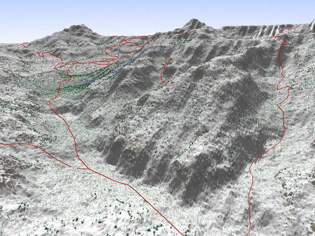
This image shows the top part of Big Cottonwood Canyon. That's Mount Superior you see at the top, just right of center. You're looking at USGS 30-meter Digital Elevation Model data with vector data also from USGS. The linear objects you see represent a highway, several trails and some ski lifts.
The camera's elevation at this point is about 9000 feet (2700 meters) above sea level.