
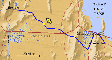
The blue line is the Hastings Trail, the yellow dot is the location
of the camera and the yellow arrow is the camera direction.
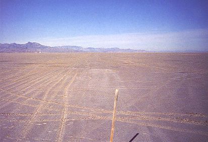
Photograph: Copyright © 1986 Roy D. Tea Made 11/5/86, Great Salt Lake Desert, Utah. View looking northwest. Here, 25 years later, is the stake placed in October 1961 to mark the trail. The trail is the lighter tracks in the center of the picture. Recent all-terrain-vehicle tracks are on the left. Floating Island is left of the white dot at the top of the flat and on the left. |
[ Return to Hastings Cutoff Exhibition ]
[ Return to Gallery ] [ Crossroads Home ]
Photographs may not be used without permission of their copyright owners.
Original content copyright ©
1997-2001 by
Utah Crossroads Chapter, Oregon-California Trails Association. All rights reserved.
Site design by Steven L. Berlin
E-mail regarding this site: Utah Crossroads
Webmaster
Revised: 10/25/04