The background for this page is a scan of a National Forest Service map I bought so that I
could find some of the back country roads and trails. It also allows me to take small sections
of the map with me on the bike instead of taking the whole map.
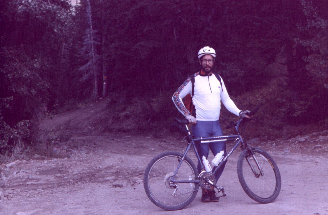
This is a photo take at the trail head to the Wasatch Crest trail that starts on one of the bends in the road
to Guardsman Pass. This was taken on my most ambitious rides of the year. I rode the bike from the mouth
of Big Cottonwood Canyon up to this point It is a climb of about 5000 feet and a distance of fifteen miles.
I made the mistake of taking a lunch break earlier and by the time this photo was taken I was suffering from
leg cramps.
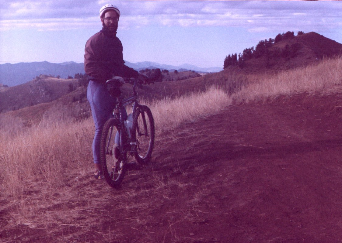
 Later on that same ride I took a photo on the ridge above Bear Trap Fork. The elevation here is a little less than
10,000 feet. You can see the east side of Mount. Olympus in the distant background.
Later on that same ride I took a photo on the ridge above Bear Trap Fork. The elevation here is a little less than
10,000 feet. You can see the east side of Mount. Olympus in the distant background.
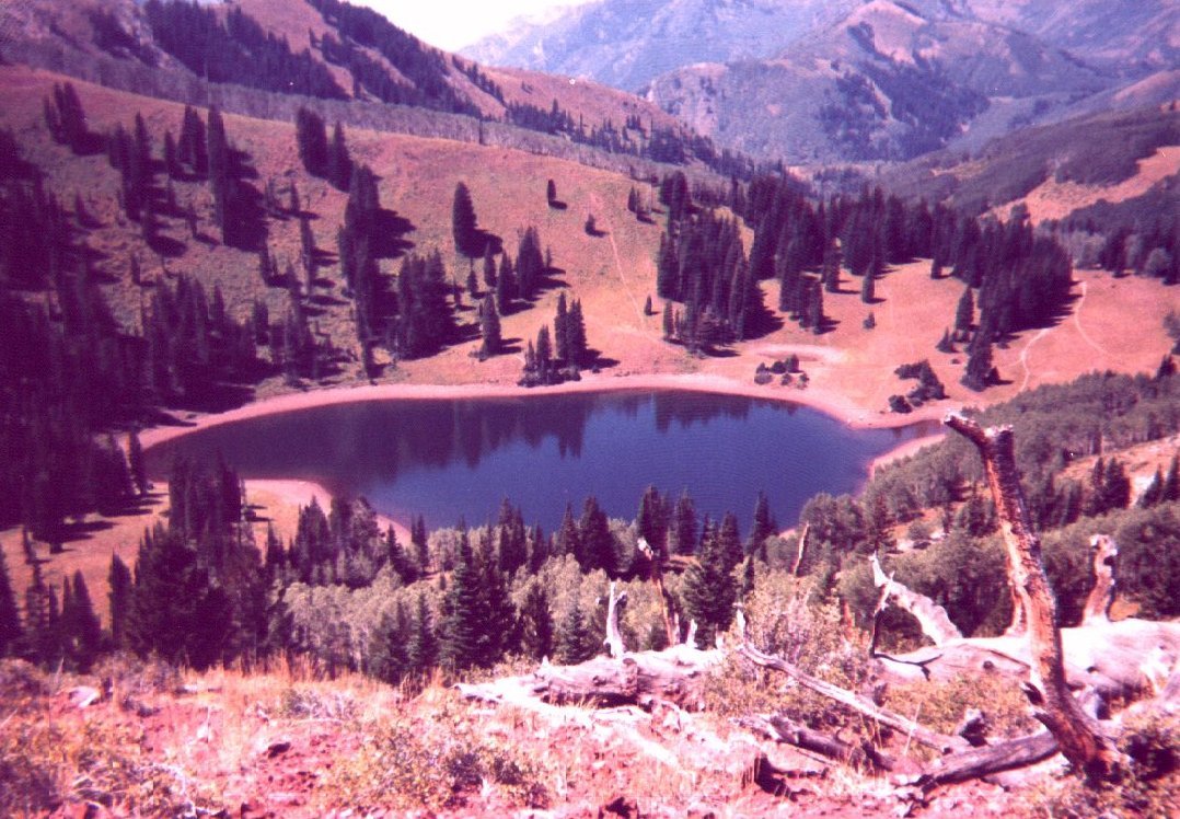
 On a different day but the same trail I took this photo overlooking Desolation Lake. You can see one of the reasons
I like to go into the back country. The views are spectacular and panoramic. The canyon in the background is the
North Fork of Mill D. The ridge from here is not rideable unless you want to tempt playing human cheese grater ten miles
from the nearest road.
On a different day but the same trail I took this photo overlooking Desolation Lake. You can see one of the reasons
I like to go into the back country. The views are spectacular and panoramic. The canyon in the background is the
North Fork of Mill D. The ridge from here is not rideable unless you want to tempt playing human cheese grater ten miles
from the nearest road.
 Sadly, I have not been riding much that last couple of years. I was hit by a truck while riding my road bike to work.
My knee and pinky finger on my left side are not what they used to be. Hopefully I'll get back on the trails again. I
gave my son a fully suspended bike for his birthday and now he has to take me. I actually got him to ride a 24 inch
hard tail bike up to Dog Lake in Millcreek Canyon when he was seven. It is about three miles long and a vertical of
nine hundred feet. It was quite a feat for such a small guy to ride that big of a bike all the way up.
Sadly, I have not been riding much that last couple of years. I was hit by a truck while riding my road bike to work.
My knee and pinky finger on my left side are not what they used to be. Hopefully I'll get back on the trails again. I
gave my son a fully suspended bike for his birthday and now he has to take me. I actually got him to ride a 24 inch
hard tail bike up to Dog Lake in Millcreek Canyon when he was seven. It is about three miles long and a vertical of
nine hundred feet. It was quite a feat for such a small guy to ride that big of a bike all the way up.