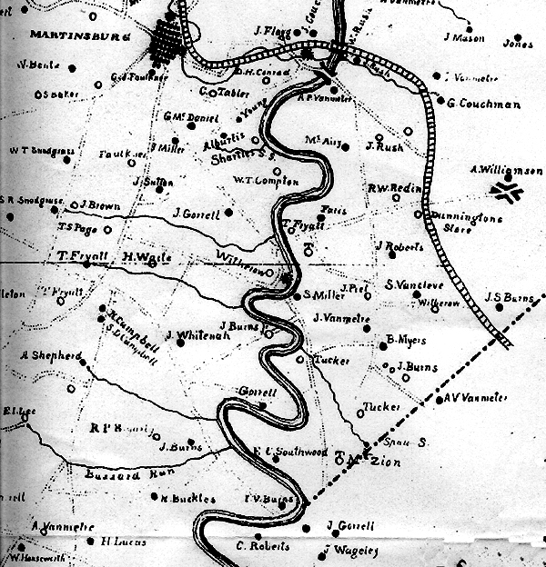
1847 Map of Berkeley County, Virginia
The following is a portion of the 1847 map of Berkely County, Virginia. The John Whitenah property is directly south and slightly east of Martinsburg. The majority of the land that John owned was owned by Henry Whiteneck.

Notice the other names of related families:
- J Burns Jr. (east of J Whitenah) This is land that originally belonged to William Burns, Henry Whiteneck's father-in-law.
- H Campbell (west of J Whitenah) Possibly land of Henry Campbell, son of Robert Campbell and Sarah Whitenah.
- EC Southwood (south and east of J Whitenah) Land originally owned by Edward Southwood, grandfather of Ruth Southwood Burns who married Joseph Henry Whitnah Sr.
- Mt. Zion (east of EC Southwood) is the location of the Mt. Zion Baptist Church, built on land donated by Edward Southwood and the Burns family.

