
Lower Bowns Reservoir / Tantalus Flats
This ride is not recommended for the winter or early spring months due to deep snow at the higher elevations. This ride starts at 8,500 feet and ends at about 5,500 feet - make sure your bike has good brakes.
Rating: moderately strenuous, with steep, downhill stretches
Skill Level: intermediate-advanced
Length: 12, 22 or 52 miles, depending on route chosen
Surface: dirt, sand, shale and creek crossings
Location: Bowns Reservoir Road and Highway 12 on Boulder Mountain
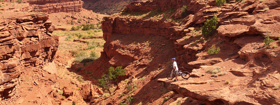
Velvet Ridge
Velvet Ridge starts at Trail head up Sand Creek road and follows a jeep trail with rocky and sandy spots. The views of Thousand Lake Mountain and the red rock colors are spectacular! Avoid when wet. The short steep climb up onto Velvet Ridge is the ride's difficult section,
but worth the effort. For a more difficult ride, do it in reverse starting at trail head on Hwy. 24 Between mile marker 63 & 64, south of Bicknell.
Rating: easy - moderate
Skill Level: novice-intermediate
Length: 9 miles with shuttle
Surface: dirt, gravel, sand
Location: Immediately west of Torrey
Capitol Reef National Park
The scenic drive starting at the park visitor center leads you to Grand Wash, Capitol Gorge, and Pleasant Creek, the first 10 miles of this ride are paved, Grand Wash is dirt and gravel, the road is narrow with no shoulders, so ride with caution. You must return on the same road so the length of your ride depends on where you turn around. Vehicle traffic can be heavy during the summer months, creating dusty conditions. You might consider this as a morning or evening ride, or during the off-season. The main road has some moderately steep grades and there are some sandy areas on the spur roads going into the canyons.
Rating: Easy
Skill Level: Novice
Length: 1 to 25 miles
Surface: Asphalt, dirt and gravel
Location: Capitol Reef National Park
Notom Road-Burr Trail - Boulder Mountain Loop
This ride encompasses some of the best scenery of the area - the west flank of Boulder Mountain through the Circle Cliffs, across the Waterpocket Fold on the Burr Trail, and then up the Strike Valley on the Notom Road. A complete loop includes about 50 miles of paved road - Highway 12 over Boulder Mountain, and Highway 24 through Capitol Reef National Park. A shuttle can shorten the ride and cut out some of the paved stretches.
Rating: strenuous
Skill Level: advanced
Length: 80 miles one way; 130 mile loop
Surface: graded dirt road, sand, asphalt
Location: Boulder Town, Highway 12
Internal Server Error
Mismatch between target UID (33) and UID (6615) of file "/home/users/c/capreef/public_html/tguide.php"
suPHP 0.8.0-pre "; echo "
$theCat sorted by community
"; $Cquery = "SELECT DISTINCT tbl_categorysub.subCatName,tbl_categorysub.ID FROM tbl_categorysub,mdl_mrebusinesslist,tbl_category WHERE tbl_categorysub.ID = mdl_mrebusinesslist.recordSubCatID AND mdl_mrebusinesslist.recordCategoryID = tbl_category.ID AND tbl_category.categoryModuleID = '26' AND tbl_category.categorySection = '$theCat' ORDER BY tbl_category.categorySortOrder"; $Cresult = mysql_query($Cquery); $count = 0; while($Crow = mysql_fetch_array($Cresult)) { echo "> $Crow[subCatName]
"; echo""; $count++; } echo"
