
HISTORY:
The earliest inhabitants of Capitol Reef Country were the Fremont People, hunters and farmers who occupied fertile lands along lakes and streams around 700 AD. These Native American Indians, relatives of Ancestral Puebloans, disappeared from the area around 1250 but left their mark on rocks and canyon walls. Paiute Indians took up residence in the area from 1600 until 1800, when the first pioneers arrived and established communities in this previously unchartered territory. The area was officially explored and documented beginning in 1872. In the 1920s, prominent local Ephraim Portman Pectol, an ardent supporter of the area’s natural beauty, joined forces with his brother-in-law Joseph S. Hickman, who organized the “Wayne Wonderland Club” to promote and preserve the region. After Hickman’s election to the Utah State legislature, 16 acres of the Fruita community were designated as a state park in 1926. The area was expanded and designated as a national monument by President Franklin D. Roosevelt in 1937, then reclassified as a national park in 1971.
BIOLOGY:
Capitol Reef National Park’s ecologically-diverse landscape is home to a variety of flora and fauna. Warblers, grosbeaks and catbirds are some of the birds that flock near the lush Fremont River, while mockingbirds, swallows and Golden Eagles nest and swoop in the desert. Reptiles in the park include western whiptail lizards, gopher snakes, and the poisonous prairie rattlesnake. Mammal residents include chipmunks, squirrels, jackrabbits, fox, bobcats, the occasional cougar and coyote, and small populations of bighorn sheep and mule deer.
Approximately 900 plant species can be found within the park boundaries. More endangered and federally-protected plants can be found in Capitol Reef than in any other Utah national park. Desert wildflowers and plants are prominent in arid areas of the park, while Fremont cottonwoods are profuse near streams, and pinion and juniper forests thrive at higher altitudes. Abundant fruit trees such as plum, apple, cherry and pear, are reminders of a once thriving pioneer community.
Biological soil crusts make up much of the ground cover in Capitol Reef National Park and play an important role in the park’s ecosystem. Soil lichen, mosses and cyanobacteria help protect the ground, prevent erosion, and help desert plants thrive.
GEOLOGY:
Capitol Reef’s landscape is the result of 200 million years of geologic history and Mesozoic strata. Exposed layers of rock and sediment reveal a varied history of ancient oceans, swamplands and desert climates. The earliest layers were deposited during the Permian period, 270 million years ago, when sandstone settled into a shallow sea bed and limestone deposits were left as the sea deepened. As a sea retreated during the Triassic period the area was exposed to silt, erosion and volcanic ash. Over millions of years slow-moving streams, barrier islands and sand bars left layers of sandstone. As ancient seas like the Western Interior Seaway came and went they left more sandstone, shale and sediment behind. The Laramide Orogeny, a major mountain building event about 70 to 50 million years ago, formed the beginnings of the Waterpocket Fold along a fault line. The uplift of the Colorado Plateau 15 million years ago, the Pleistocene ice age, and erosion from wind and water further developed the Waterpocket Fold monocline.
TOPOGRAPHY:
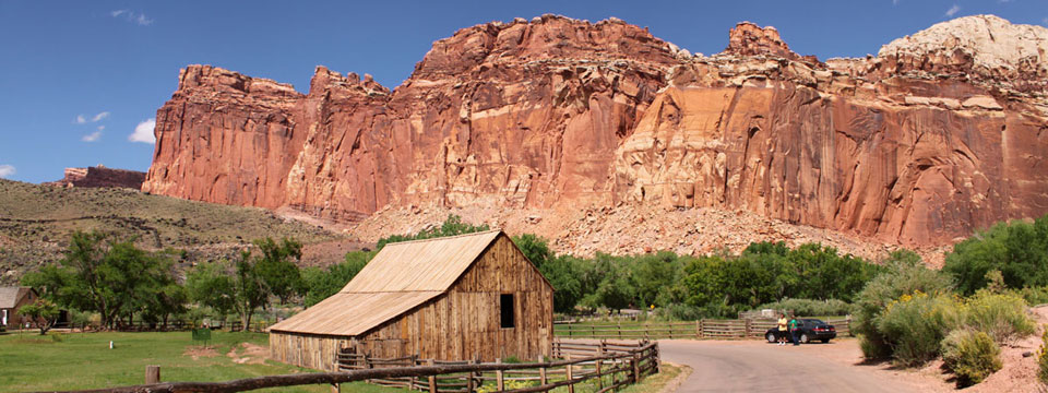
From the soaring monoliths of Cathedral Valley to the round formations of the Bentonite Hills and the desolate Caineville Badlands, Capitol Reef National Park’s 254,251 acres are unmatched in geological diversity. The landscape is largely defined by the 100-mile long Waterpocket Fold, a classic monocline uplifted 7000 feet on the west side. White sandstone cliffs and domes, red-hued canyons, massive monoliths, mountain lakes and backcountry create a breathtaking exhibit of rugged texture and color. Desert landscape is dominant, but pinion, juniper and cottonwoods grow in the lush forests and lakeside soil. The park is named for the white domes and cliffs resembling the United States Capitol building, and for the nearly impassable ‘barrier reef’ cliffs that early explorers encountered.
UNIQUE FORMATIONS:
The Waterpocket Fold is the most distinguishing feature in the park, a 100-mile long classic monocline uplifted 7000 feet on the west side.
Capitol Dome is a massive white sandstone formation that resembles the U.S. Capitol building. The park was partly named for this landmark.
Chimney Rock is a towering 400-foot-tall sandstone pillar, located three miles west of the visitor center off Highway 24 and accessible via a short hiking trail.
Hickman Bridge is a huge natural arch spanning 133 feet wide and 125 feet tall. The arch is named after Joseph S. Hickman, an early advocate for Capitol Reef’s preservation.
The Castle, an impressive craggy sandstone formation visible from Highway 24.
Cassidy Arch, a pink Kayenta sandstone arch spanning 50 feet, above the Grand Wash. Accessible by a moderate three-mile roundtrip hike.
The Bentonite Hills are round formations with a checkerboard facade, located 9 miles from River Ford.
Temple of the Sun, Temple of the Moon and The Walls of Jericho are some of the massive monoliths (standing 400 to 500 feet high) located in the scenic Cathedral Valley.
Gypsum Sinkhole, is a 200-foot deep sinkhole, 50 feet in diameter, near the Cathedral Valley Junction.
> Capitol Reef Information
> Capitol Reef History
> Capitol Reef More
