![]()
Photograph Exhibition
Route of the First Transcontinental Railroad
Chapter Field Trip
Near Grantsville, Utah to Golden Spike National Historic Site at Promontory Point, Utah
October 18, 1997
![]()
We gathered not far from Grantsville, Utah (sometimes known at the beginning of the trails era and before Mormon settlement as Twenty Wells or Hastings Wells), about 25 miles west of Salt Lake City and crossed the great salt desert to the west on Interstate 80 in a little over an hour. Emigrants and argonauts on what became known as the Hastings Road typically spent two or more days of forced march often travelling day and night to cross this waterless landscape. Wagons were abandoned and animals lost on the treacherous flats. Human deaths were reported. The field trip began with visits to traces along the Utah-Nevada border of a route pioneered by the Bidwell-Bartelson party of 1841 and later traveled by both famous and forgotten users of the Hastings Cutoff west of the great salt desert. The highlight of the field trip was driving over 90 miles of the original 1869 Transcontinental Railroad grade and visiting historic sites along the way. Though the completion of the railroad officially ended the pioneer era and the necessity of travelling the old emigrant roads to the West, the historic and well-preserved railbed is a must-see for trail buffs.
To see captions and full-size versions of the pictures, click on a picture "thumbnail" |
| 1. Kiosk Site Near Pilot Peak N of Wendover, UT |
2. Kiosk Site Bidwell-Bartleson Route N of Wendover, UT |
||
| 3. Kiosk Site also Hastings Road N of Wendover, UT |
4. Donner Spring at Foot of Pilot Peak N of Wendover, UT |
||
| 5. George Ivory at Donner Spring N of Wendover, UT |
6. Salt Desert from Donner Spring N of Wendover, UT |
||
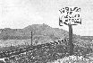
| 7. BLM Sign Transcontinental RR Grade Lucin, UT |
8. Al Mulder Gets a Flat E of Lucin, UT |
||
| 9. Historical Photograph Laying Track on Central Pacific RR Near Lucin, UT |
10. Wooden Trestle Ca. Turn of the Century ~10 Miles E of Lucin, UT |
||
| 11. Terrace ~25 Miles E of Lucin, UT |
12. Another @#! Flat E of Terrace, UT |
||
| 13. Kelton Cemetery W of Promontory Summit, UT |
14. The Pres. Gets a Flat E of Kelton, UT |
||
| 15. Final Miles W of Promontory Summit, UT |
16. Historical Photograph Ten Miles of Track in One Day! Near Promontory Summit, UT |
 |
Home | Activities
| Contact Us | Forum | Lectures
| Join Us | Links
| Members | News | Newsletter
Picture Gallery | Publications | Trails
| Trail Marking | Members' Pages | Search |
OCTA
Chapters | OCTA
Original content copyright ©
1997-2007 by
Utah Crossroads Chapter, Oregon-California Trails Association. All rights reserved.
Trademarks, Service Marks and Logos are property of their respective owners.
Site design by Steve. Berlin
E-mail regarding this site: Utah
Crossroads Webmaster
Revised: 12 Apr 2007

